Serviès geodata
Serviès (Occitanie) is a populated place; located in France in Europe/Paris (GMT+2) time zone. With population of 540 people, there are 14387 cities with bigger population in this country. Compared to other cities in France, 91.1% of cities are located further ↑North; 56.8% of cities are located further →East and 56.3% of cities have lower elevation than Serviès. Note1
Administrative division(s):
- Level 1: Occitanie
- Level 2: Tarn
- Level 3: Arrondissement de Castres
- Level 4: Serviès


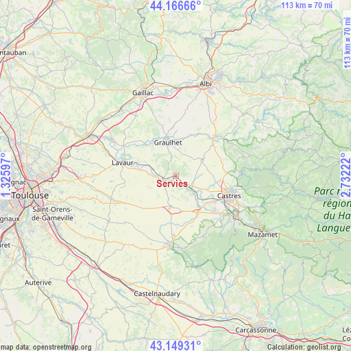
Serviès GPS coordinates[2]
43° 39' 36.504" North, 2° 1' 44.76" East
| Map corner | latitude | longitude |
|---|---|---|
| Upper-left | 44.16666°, | 1.32597° |
| Center: | 43.66014°, | 2.0291° |
| Lower-right: | 43.14931°, | 2.73222° |
| Map W x H: | 113.1×113.1 km | = 70.3×70.3mi |
| max Lat: | 51.07786° ⇑91.1% North |
| Serviès: | 43.66014° |
| min Lat: | ⇓8.9% South 41.3874° |
| min Long | Serviès | max Long |
| -5.08615° | 2.0291° | 9.52242° |
| W 43.2%⇐ | ⇒56.8% E |
Elevation
Elevation of Serviès is 155 m = 509 ft, and this is 38.7 m = 127 ft below average elevation for this country.
| Max E: |
2333 m = 7654 ft | 43.7% |
| Avg. | 193.7 m = 635 ft | |
| Serviès | 155 m = 509 ft | |
Min E: |
-1 m = -3 ft | 56.3% |
See also: France elevation on elevation.city.
Geographical zone
Serviès is located in North temperate zone (between Tropic of Cancer and the Arctic Circle). Distance of this Northern Tropic circle is 2248.6 km =1397.2 mi to South.| Distance of | km | miles | from Serviès |
|---|---|---|---|
| North Pole | 5152.5 | 3201.6 | to North |
| Arctic Circle | 2546.6 | 1582.4 | to North |
| Tropic Cancer | 2248.6 | 1397.2 | to South |
| Equator | 4854.6 | 3016.5 | to South |


Nearby cities:
15 places around Serviès: (largest is in red/bold)
• Briatexte
14.1 km =8.8 mi,  316°
316°
• Busque
14.7 km =9.1 mi,  337°
337°
• Cambounet-sur-le-Sor
11.7 km =7.3 mi,  142°
142°
• Damiatte
4.3 km =2.7 mi,  258°
258°
• Fiac
10.8 km =6.7 mi,  295°
295°
• Fréjeville
10.6 km =6.6 mi,  121°
121°
• Graulhet
12.3 km =7.6 mi, 344°
• Lautrec
10.2 km =6.3 mi,  60°
60°
• Puylaurens
9.9 km =6.2 mi,  187°
187°
• Saint-Gauzens
14.2 km =8.8 mi,  312°
312°
• Saint-Germain-des-Prés
11.3 km =7 mi,  164°
164°
• Saint-Paul-Cap-de-Joux
4.5 km =2.8 mi,  252°
252°
• Soual
13.6 km =8.5 mi,  148°
148°
• Sémalens
10.1 km =6.3 mi, 138°
• Vielmur-sur-Agout
7.5 km =4.7 mi,  130°
130°
Sources, notices
• [Note1] Compared only with cities in France existing in our database
• [Src1] Map data: © OpenStreetMap contributors (CC-BY-SA)
• [Src2] Other city data from geonames.org with taken over terms of usage.
• [Src3] Geographical zone / Annual Mean Temperature by Robert A. Rohde @ Wikipedia
