Cuinzier geodata
Cuinzier (Auvergne-Rhône-Alpes) is a populated place; located in France in Europe/Paris (GMT+2) time zone. With population of 574 people, there are 13763 cities with bigger population in this country. Compared to other cities in France, 64.7% of cities are located further ↑North; 70.3% of cities are located further ←West and 91.8% of cities have lower elevation than Cuinzier. Note1
Administrative division(s):
- Level 1: Auvergne-Rhône-Alpes
- Level 2: Département de la Loire
- Level 3: Arrondissement de Roanne
- Level 4: Cuinzier


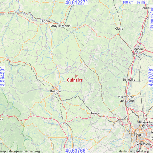
Cuinzier GPS coordinates[2]
46° 7' 37.632" North, 4° 16' 3.576" East
| Map corner | latitude | longitude |
|---|---|---|
| Upper-left | 46.61227°, | 3.56453° |
| Center: | 46.12712°, | 4.26766° |
| Lower-right: | 45.63766°, | 4.97078° |
| Map W x H: | 108.4×108.4 km | = 67.4×67.4mi |
| max Lat: | 51.07786° ⇑64.7% North |
| Cuinzier: | 46.12712° |
| min Lat: | ⇓35.3% South 41.3874° |
| min Long | Cuinzier | max Long |
| -5.08615° | 4.26766° | 9.52242° |
| W 70.3%⇐ | ⇒29.7% E |
Elevation
Elevation of Cuinzier is 468 m = 1535 ft, and this is 274.3 m = 900 ft above average elevation for this country.
| Max E: |
2333 m = 7654 ft | 8.2% |
| Cuinzier | 468 m 1535 ft | |
| Avg. | 193.7 m = 635 ft | |
Min E: |
-1 m = -3 ft | 91.8% |
See also: France elevation on elevation.city.
Geographical zone
Cuinzier is located in North temperate zone (between Tropic of Cancer and the Arctic Circle). Distance of this North polar circle is 2272.3 km =1411.9 mi to North.| Distance of | km | miles | from Cuinzier |
|---|---|---|---|
| North Pole | 4878.2 | 3031.2 | to North |
| Arctic Circle | 2272.3 | 1411.9 | to North |
| Tropic Cancer | 2522.9 | 1567.7 | to South |
| Equator | 5128.9 | 3186.9 | to South |


Nearby cities:
15 places around Cuinzier: (largest is in red/bold)
• Belmont-de-la-Loire
7.5 km =4.7 mi,  54°
54°
• Chandon
4.8 km =3 mi,  300°
300°
• Charlieu
8.3 km =5.2 mi, 297°
• Coublanc
5.3 km =3.3 mi,  4°
4°
• Cours-la-Ville
4.8 km =3 mi,  128°
128°
• Coutouvre
7.7 km =4.8 mi,  218°
218°
• La Gresle
5.7 km =3.5 mi,  166°
166°
• Le Cergne
3.3 km =2.1 mi,  100°
100°
• Mardore
8.3 km =5.2 mi,  139°
139°
• Mars
3.4 km =2.1 mi,  328°
328°
• Pont-Trambouze
7.1 km =4.4 mi,  149°
149°
• Saint-Denis-de-Cabanne
6.5 km =4 mi,  320°
320°
• Saint-Igny-de-Roche
7.7 km =4.8 mi,  14°
14°
• Sevelinges
3.9 km =2.4 mi, 145°
• Villers
3.6 km =2.2 mi,  259°
259°
Sources, notices
• [Note1] Compared only with cities in France existing in our database
• [Src1] Map data: © OpenStreetMap contributors (CC-BY-SA)
• [Src2] Other city data from geonames.org with taken over terms of usage.
• [Src3] Geographical zone / Annual Mean Temperature by Robert A. Rohde @ Wikipedia
