Crotenay geodata
Crotenay (Bourgogne-Franche-Comté) is a populated place; located in France in Europe/Paris (GMT+2) time zone. With population of 732 people, there are 11386 cities with bigger population in this country. Compared to other cities in France, 57.7% of cities are located further ↑North; 85.2% of cities are located further ←West and 93.3% of cities have lower elevation than Crotenay. Note1
Administrative division(s):
- Level 1: Bourgogne-Franche-Comté
- Level 2: Jura
- Level 3: Arrondissement de Lons-le-Saunier
- Level 4: Crotenay


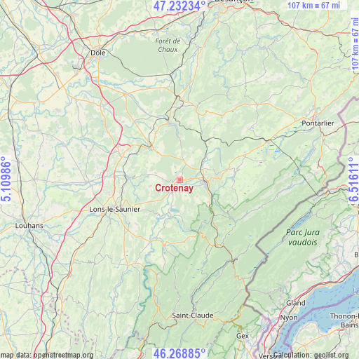
Crotenay GPS coordinates[2]
46° 45' 9.9" North, 5° 48' 46.728" East
| Map corner | latitude | longitude |
|---|---|---|
| Upper-left | 47.23234°, | 5.10986° |
| Center: | 46.75275°, | 5.81298° |
| Lower-right: | 46.26885°, | 6.51611° |
| Map W x H: | 107.1×107.1 km | = 66.5×66.5mi |
| max Lat: | 51.07786° ⇑57.7% North |
| Crotenay: | 46.75275° |
| min Lat: | ⇓42.3% South 41.3874° |
| min Long | Crotenay | max Long |
| -5.08615° | 5.81298° | 9.52242° |
| W 85.2%⇐ | ⇒14.8% E |
Elevation
Elevation of Crotenay is 517 m = 1696 ft, and this is 323.3 m = 1061 ft above average elevation for this country.
| Max E: |
2333 m = 7654 ft | 6.7% |
| Crotenay | 517 m 1696 ft | |
| Avg. | 193.7 m = 635 ft | |
Min E: |
-1 m = -3 ft | 93.3% |
See also: France elevation on elevation.city.
Geographical zone
Crotenay is located in North temperate zone (between Tropic of Cancer and the Arctic Circle). Distance of this North polar circle is 2202.8 km =1368.8 mi to North.| Distance of | km | miles | from Crotenay |
|---|---|---|---|
| North Pole | 4808.6 | 2987.9 | to North |
| Arctic Circle | 2202.8 | 1368.8 | to North |
| Tropic Cancer | 2592.5 | 1610.9 | to South |
| Equator | 5198.4 | 3230.1 | to South |


Nearby cities:
15 places around Crotenay: (largest is in red/bold)
• Andelot-en-Montagne
14.4 km =8.9 mi,  39°
39°
• Arbois
17 km =10.6 mi,  350°
350°
• Champagnole
7.7 km =4.8 mi,  96°
96°
• Cize
8.7 km =5.4 mi,  111°
111°
• Conliège
19.6 km =12.2 mi,  236°
236°
• Crançot
13.9 km =8.6 mi, 237°
• Domblans
16.5 km =10.3 mi,  274°
274°
• La Chaux-du-Dombief
18 km =11.2 mi,  158°
158°
• Mesnay
16.3 km =10.1 mi,  356°
356°
• Ney
5.9 km =3.7 mi, 108°
• Poligny
12.5 km =7.8 mi,  318°
318°
• Saint-Germain-lès-Arlay
19.3 km =12 mi, 272°
• Sirod
13.2 km =8.2 mi, 99°
• Voiteur
15.4 km =9.6 mi, 270°
• Équevillon
9.7 km =6 mi,  85°
85°
Sources, notices
• [Note1] Compared only with cities in France existing in our database
• [Src1] Map data: © OpenStreetMap contributors (CC-BY-SA)
• [Src2] Other city data from geonames.org with taken over terms of usage.
• [Src3] Geographical zone / Annual Mean Temperature by Robert A. Rohde @ Wikipedia
