Courson-les-Carrières geodata
Courson-les-Carrières (Bourgogne-Franche-Comté) is a populated place; located in France in Europe/Paris (GMT+2) time zone. With population of 821 people, there are 10382 cities with bigger population in this country. Compared to other cities in France, 52.8% of cities are located further ↓South; 64.2% of cities are located further ←West and 71.2% of cities have lower elevation than Courson-les-Carrières. Note1
Administrative division(s):
- Level 1: Bourgogne-Franche-Comté
- Level 2: Département de l'Yonne
- Level 3: Auxerre
- Level 4: Courson-les-Carrières
Current local time in Courson-les-Carrières:
08:43 AM, SaturdayDifference from your time zone: hours


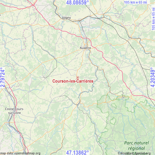
Courson-les-Carrières GPS coordinates[2]
47° 36' 53.1" North, 3° 30' 1.296" East
| Map corner | latitude | longitude |
|---|---|---|
| Upper-left | 48.08659°, | 2.79724° |
| Center: | 47.61475°, | 3.50036° |
| Lower-right: | 47.13862°, | 4.20349° |
| Map W x H: | 105.4×105.4 km | = 65.5×65.5mi |
| max Lat: | 51.07786° ⇑47.2% North |
| Courson-les-Carrières: | 47.61475° |
| min Lat: | ⇓52.8% South 41.3874° |
| min Long | Courson-les-Car | max Long |
| -5.08615° | 3.50036° | 9.52242° |
| W 64.2%⇐ | ⇒35.8% E |
Elevation
Elevation of Courson-les-Carrières is 225 m = 738 ft, and this is 31.3 m = 103 ft above average elevation for this country.
| Max E: |
2333 m = 7654 ft | 28.8% |
| Courson-les-Carrières | 225 m 738 ft | |
| Avg. | 193.7 m = 635 ft | |
Min E: |
-1 m = -3 ft | 71.2% |
See also: France elevation on elevation.city.
Geographical zone
Courson-les-Carrières is located in North temperate zone (between Tropic of Cancer and the Arctic Circle). Distance of this North polar circle is 2106.9 km =1309.2 mi to North.| Distance of | km | miles | from Courson-les-Carrières |
|---|---|---|---|
| North Pole | 4712.8 | 2928.4 | to North |
| Arctic Circle | 2106.9 | 1309.2 | to North |
| Tropic Cancer | 2688.3 | 1670.4 | to South |
| Equator | 5294.3 | 3289.7 | to South |


Nearby cities:
15 places around Courson-les-Carrières: (largest is in red/bold)
• Champs-sur-Yonne
15.1 km =9.4 mi,  29°
29°
• Châtel-Censoir
13.5 km =8.4 mi,  132°
132°
• Coulanges-la-Vineuse
11.4 km =7.1 mi, 32°
• Coulanges-sur-Yonne
10.2 km =6.3 mi,  163°
163°
• Cravant
16.2 km =10.1 mi,  61°
61°
• Diges
14.8 km =9.2 mi,  328°
328°
• Escamps
12.9 km =8 mi,  351°
351°
• Escolives-Sainte-Camille
14 km =8.7 mi,  35°
35°
• Fontenailles
7.8 km =4.8 mi,  201°
201°
• Mailly-la-Ville
13.7 km =8.5 mi,  96°
96°
• Mailly-le-Château
10.4 km =6.5 mi, 101°
• Ouanne
8 km =5 mi,  309°
309°
• Vallan
14.7 km =9.1 mi,  11°
11°
• Vincelles
14 km =8.7 mi,  45°
45°
• Étais-la-Sauvin
17 km =10.6 mi,  223°
223°
Sources, notices
• [Note1] Compared only with cities in France existing in our database
• [Src1] Map data: © OpenStreetMap contributors (CC-BY-SA)
• [Src2] Other city data from geonames.org with taken over terms of usage.
• [Src3] Geographical zone / Annual Mean Temperature by Robert A. Rohde @ Wikipedia
