Coulanges-la-Vineuse geodata
Coulanges-la-Vineuse (Bourgogne-Franche-Comté) is a populated place; located in France in Europe/Paris (GMT+2) time zone. With population of 957 people, there are 9150 cities with bigger population in this country. Compared to other cities in France, 54.3% of cities are located further ↓South; 64.9% of cities are located further ←West and 64.2% of cities have lower elevation than Coulanges-la-Vineuse. Note1
Administrative division(s):
- Level 1: Bourgogne-Franche-Comté
- Level 2: Département de l'Yonne
- Level 3: Auxerre
- Level 4: Coulanges-la-Vineuse


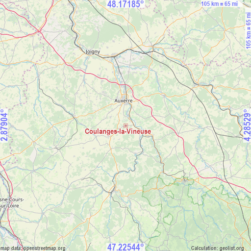
Coulanges-la-Vineuse GPS coordinates[2]
47° 42' 2.844" North, 3° 34' 55.812" East
| Map corner | latitude | longitude |
|---|---|---|
| Upper-left | 48.17185°, | 2.87904° |
| Center: | 47.70079°, | 3.58217° |
| Lower-right: | 47.22544°, | 4.28529° |
| Map W x H: | 105.2×105.2 km | = 65.4×65.4mi |
| max Lat: | 51.07786° ⇑45.7% North |
| Coulanges-la-Vineuse: | 47.70079° |
| min Lat: | ⇓54.3% South 41.3874° |
| min Long | Coulanges-la-Vi | max Long |
| -5.08615° | 3.58217° | 9.52242° |
| W 64.9%⇐ | ⇒35.1% E |
Elevation
Elevation of Coulanges-la-Vineuse is 190 m = 623 ft, and this is 3.7 m = 12 ft below average elevation for this country.
| Max E: |
2333 m = 7654 ft | 35.8% |
| Avg. | 193.7 m = 635 ft | |
| Coulanges-la-Vineuse | 190 m = 623 ft | |
Min E: |
-1 m = -3 ft | 64.2% |
See also: France elevation on elevation.city.
Geographical zone
Coulanges-la-Vineuse is located in North temperate zone (between Tropic of Cancer and the Arctic Circle). Distance of this North polar circle is 2097.3 km =1303.2 mi to North.| Distance of | km | miles | from Coulanges-la-Vineuse |
|---|---|---|---|
| North Pole | 4703.2 | 2922.4 | to North |
| Arctic Circle | 2097.3 | 1303.2 | to North |
| Tropic Cancer | 2697.9 | 1676.4 | to South |
| Equator | 5303.8 | 3295.6 | to South |


Nearby cities:
15 places around Coulanges-la-Vineuse: (largest is in red/bold)
• Augy
7.6 km =4.7 mi,  16°
16°
• Auxerre
11 km =6.8 mi,  355°
355°
• Champs-sur-Yonne
3.9 km =2.4 mi, 20°
• Courson-les-Carrières
11.4 km =7.1 mi,  212°
212°
• Cravant
8.4 km =5.2 mi,  103°
103°
• Escamps
8.7 km =5.4 mi,  291°
291°
• Escolives-Sainte-Camille
2.7 km =1.7 mi,  45°
45°
• Mailly-le-Château
12.3 km =7.6 mi,  160°
160°
• Saint-Bris-le-Vineux
6.9 km =4.3 mi, 46°
• Saint-Georges-sur-Baulche
11.7 km =7.3 mi,  341°
341°
• Vallan
5.8 km =3.6 mi,  326°
326°
• Venoy
12.3 km =7.6 mi, 19°
• Vermenton
12.1 km =7.5 mi,  109°
109°
• Villefargeau
10.6 km =6.6 mi, 326°
• Vincelles
3.8 km =2.4 mi,  86°
86°
Sources, notices
• [Note1] Compared only with cities in France existing in our database
• [Src1] Map data: © OpenStreetMap contributors (CC-BY-SA)
• [Src2] Other city data from geonames.org with taken over terms of usage.
• [Src3] Geographical zone / Annual Mean Temperature by Robert A. Rohde @ Wikipedia
