Courgains geodata
Courgains (Pays de la Loire) is a populated place; located in France in Europe/Paris (GMT+2) time zone. With population of 543 people, there are 14333 cities with bigger population in this country. Compared to other cities in France, 64.4% of cities are located further ↓South; 75.5% of cities are located further →East and 60.4% of cities have higher elevation than Courgains. Note1
Administrative division(s):
- Level 1: Pays de la Loire
- Level 2: Sarthe
- Level 3: Arrondissement de Mamers
- Level 4: Courgains


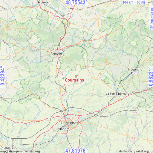
Courgains GPS coordinates[2]
48° 17' 23.064" North, 0° 16' 45.048" East
| Map corner | latitude | longitude |
|---|---|---|
| Upper-left | 48.75543°, | -0.42394° |
| Center: | 48.28974°, | 0.27918° |
| Lower-right: | 47.81976°, | 0.98231° |
| Map W x H: | 104×104 km | = 64.6×64.6mi |
| max Lat: | 51.07786° ⇑35.6% North |
| Courgains: | 48.28974° |
| min Lat: | ⇓64.4% South 41.3874° |
| min Long | Courgains | max Long |
| -5.08615° | 0.27918° | 9.52242° |
| W 24.5%⇐ | ⇒75.5% E |
Elevation
Elevation of Courgains is 101 m = 331 ft, and this is 92.7 m = 304 ft below average elevation for this country.
| Max E: |
2333 m = 7654 ft | 60.4% |
| Avg. | 193.7 m = 635 ft | |
| Courgains | 101 m = 331 ft | |
Min E: |
-1 m = -3 ft | 39.6% |
See also: France elevation on elevation.city.
Geographical zone
Courgains is located in North temperate zone (between Tropic of Cancer and the Arctic Circle). Distance of this North polar circle is 2031.9 km =1262.6 mi to North.| Distance of | km | miles | from Courgains |
|---|---|---|---|
| North Pole | 4637.7 | 2881.7 | to North |
| Arctic Circle | 2031.9 | 1262.6 | to North |
| Tropic Cancer | 2763.4 | 1717.1 | to South |
| Equator | 5369.3 | 3336.3 | to South |


Nearby cities:
15 places around Courgains: (largest is in red/bold)
• Ancinnes
11.5 km =7.1 mi,  318°
318°
• Ballon
13.3 km =8.3 mi,  193°
193°
• Beaumont-sur-Sarthe
12.9 km =8 mi,  237°
237°
• Champfleur
15.4 km =9.6 mi,  314°
314°
• Courcemont
14.1 km =8.8 mi,  157°
157°
• Dangeul
5 km =3.1 mi,  198°
198°
• Fyé
15.3 km =9.5 mi,  285°
285°
• Mamers
9.4 km =5.8 mi,  45°
45°
• Maresché
12.7 km =7.9 mi,  227°
227°
• Marolles-les-Braults
5 km =3.1 mi,  146°
146°
• Neufchâtel-en-Saosnois
10 km =6.2 mi,  346°
346°
• Saint-Cosme-en-Vairais
14.1 km =8.8 mi,  100°
100°
• Saint-Mars-sous-Ballon
13.3 km =8.3 mi, 190°
• Saint-Rémy-des-Monts
9.2 km =5.7 mi,  76°
76°
• Vivoin
11.1 km =6.9 mi, 235°
Sources, notices
• [Note1] Compared only with cities in France existing in our database
• [Src1] Map data: © OpenStreetMap contributors (CC-BY-SA)
• [Src2] Other city data from geonames.org with taken over terms of usage.
• [Src3] Geographical zone / Annual Mean Temperature by Robert A. Rohde @ Wikipedia
