Neufchâtel-en-Saosnois geodata
Neufchâtel-en-Saosnois (Pays de la Loire) is a populated place; located in France in Europe/Paris (GMT+2) time zone. With population of 795 people, there are 10669 cities with bigger population in this country. Compared to other cities in France, 65.9% of cities are located further ↓South; 75.8% of cities are located further →East and 58% of cities have lower elevation than Neufchâtel-en-Saosnois. Note1
Administrative division(s):
- Level 1: Pays de la Loire
- Level 2: Sarthe
- Level 3: Arrondissement de Mamers
- Level 4: Neufchâtel-en-Saosnois
Current local time in Neufchâtel-en-Saosnois:
02:19 PM, SaturdayDifference from your time zone: hours


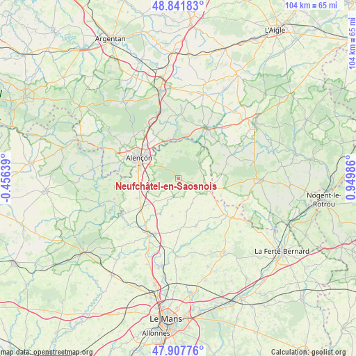
Neufchâtel-en-Saosnois GPS coordinates[2]
48° 22' 36.984" North, 0° 14' 48.264" East
| Map corner | latitude | longitude |
|---|---|---|
| Upper-left | 48.84183°, | -0.45639° |
| Center: | 48.37694°, | 0.24674° |
| Lower-right: | 47.90776°, | 0.94986° |
| Map W x H: | 103.9×103.9 km | = 64.6×64.6mi |
| max Lat: | 51.07786° ⇑34.1% North |
| Neufchâtel-en-Saosnois: | 48.37694° |
| min Lat: | ⇓65.9% South 41.3874° |
| min Long | Neufchâtel-en- | max Long |
| -5.08615° | 0.24674° | 9.52242° |
| W 24.2%⇐ | ⇒75.8% E |
Elevation
Elevation of Neufchâtel-en-Saosnois is 161 m = 528 ft, and this is 32.7 m = 107 ft below average elevation for this country.
| Max E: |
2333 m = 7654 ft | 42% |
| Avg. | 193.7 m = 635 ft | |
| Neufchâtel-en-Saosnois | 161 m = 528 ft | |
Min E: |
-1 m = -3 ft | 58% |
See also: France elevation on elevation.city.
Geographical zone
Neufchâtel-en-Saosnois is located in North temperate zone (between Tropic of Cancer and the Arctic Circle). Distance of this North polar circle is 2022.2 km =1256.5 mi to North.| Distance of | km | miles | from Neufchâtel-en-Saosnois |
|---|---|---|---|
| North Pole | 4628.1 | 2875.8 | to North |
| Arctic Circle | 2022.2 | 1256.5 | to North |
| Tropic Cancer | 2773.1 | 1723.1 | to South |
| Equator | 5379 | 3342.4 | to South |


Nearby cities:
15 places around Neufchâtel-en-Saosnois: (largest is in red/bold)
• Alençon
13 km =8.1 mi,  299°
299°
• Ancinnes
5.3 km =3.3 mi,  258°
258°
• Arçonnay
12.1 km =7.5 mi,  280°
280°
• Cerisé
11.7 km =7.3 mi,  314°
314°
• Champfleur
8.7 km =5.4 mi, 277°
• Courgains
10 km =6.2 mi,  166°
166°
• Dangeul
14.5 km =9 mi,  176°
176°
• Fyé
13.6 km =8.5 mi,  245°
245°
• La Fresnaye-sur-Chédouet
7.9 km =4.9 mi,  4°
4°
• Le Chevain
10.6 km =6.6 mi, 304°
• Mamers
9.6 km =6 mi,  108°
108°
• Oisseau-le-Petit
12.3 km =7.6 mi, 254°
• Saint-Paterne
10.8 km =6.7 mi,  293°
293°
• Saint-Rémy-des-Monts
13.6 km =8.5 mi,  123°
123°
• Valframbert
14.1 km =8.8 mi, 313°
Sources, notices
• [Note1] Compared only with cities in France existing in our database
• [Src1] Map data: © OpenStreetMap contributors (CC-BY-SA)
• [Src2] Other city data from geonames.org with taken over terms of usage.
• [Src3] Geographical zone / Annual Mean Temperature by Robert A. Rohde @ Wikipedia
