Corgoloin geodata
Corgoloin (Bourgogne-Franche-Comté) is a populated place; located in France in Europe/Paris (GMT+2) time zone. With population of 935 people, there are 9342 cities with bigger population in this country. Compared to other cities in France, 54.4% of cities are located further ↑North; 76.7% of cities are located further ←West and 72.2% of cities have lower elevation than Corgoloin. Note1
Administrative division(s):
- Level 1: Bourgogne-Franche-Comté
- Level 2: Département de la Côte-d'Or
- Level 3: Arrondissement de Beaune
- Level 4: Corgoloin


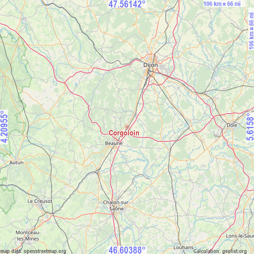
Corgoloin GPS coordinates[2]
47° 5' 5.28" North, 4° 54' 45.648" East
| Map corner | latitude | longitude |
|---|---|---|
| Upper-left | 47.56142°, | 4.20955° |
| Center: | 47.0848°, | 4.91268° |
| Lower-right: | 46.60388°, | 5.6158° |
| Map W x H: | 106.5×106.5 km | = 66.2×66.2mi |
| max Lat: | 51.07786° ⇑54.4% North |
| Corgoloin: | 47.0848° |
| min Lat: | ⇓45.6% South 41.3874° |
| min Long | Corgoloin | max Long |
| -5.08615° | 4.91268° | 9.52242° |
| W 76.7%⇐ | ⇒23.3% E |
Elevation
Elevation of Corgoloin is 231 m = 758 ft, and this is 37.3 m = 122 ft above average elevation for this country.
| Max E: |
2333 m = 7654 ft | 27.8% |
| Corgoloin | 231 m 758 ft | |
| Avg. | 193.7 m = 635 ft | |
Min E: |
-1 m = -3 ft | 72.2% |
See also: France elevation on elevation.city.
Geographical zone
Corgoloin is located in North temperate zone (between Tropic of Cancer and the Arctic Circle). Distance of this North polar circle is 2165.8 km =1345.8 mi to North.| Distance of | km | miles | from Corgoloin |
|---|---|---|---|
| North Pole | 4771.7 | 2965 | to North |
| Arctic Circle | 2165.8 | 1345.8 | to North |
| Tropic Cancer | 2629.4 | 1633.8 | to South |
| Equator | 5235.3 | 3253.1 | to South |


Nearby cities:
15 places around Corgoloin: (largest is in red/bold)
• Beaune
8.8 km =5.5 mi,  219°
219°
• Bligny-lès-Beaune
12.8 km =8 mi,  210°
210°
• Chorey-les-Beaune
5.2 km =3.2 mi, 222°
• Comblanchien
2 km =1.2 mi,  19°
19°
• Flagey-Echézeaux
10.6 km =6.6 mi,  30°
30°
• Gilly-lès-Cîteaux
10.4 km =6.5 mi, 29°
• Ladoix-Serrigny
3 km =1.9 mi,  227°
227°
• Montagny-lès-Beaune
11.4 km =7.1 mi,  204°
204°
• Morey-Saint-Denis
13 km =8.1 mi, 16°
• Nuits-Saint-Georges
6.4 km =4 mi, 25°
• Pommard
12.2 km =7.6 mi, 226°
• Ruffey-lès-Beaune
7.4 km =4.6 mi,  179°
179°
• Sainte-Marie-la-Blanche
12 km =7.5 mi,  188°
188°
• Savigny-lès-Beaune
7.5 km =4.7 mi,  251°
251°
• Vignoles
6.5 km =4 mi, 197°
Sources, notices
• [Note1] Compared only with cities in France existing in our database
• [Src1] Map data: © OpenStreetMap contributors (CC-BY-SA)
• [Src2] Other city data from geonames.org with taken over terms of usage.
• [Src3] Geographical zone / Annual Mean Temperature by Robert A. Rohde @ Wikipedia
