Cintré geodata
Cintré (Brittany) is a populated place; located in France in Europe/Paris (GMT+2) time zone. With population of 1,601 people, there are 5828 cities with bigger population in this country. Compared to other cities in France, 61.2% of cities are located further ↓South; 94.4% of cities are located further →East and 86.2% of cities have higher elevation than Cintré. Note1
Administrative division(s):
- Level 1: Brittany
- Level 2: Département d'Ille-et-Vilaine
- Level 3: Arrondissement de Rennes
- Level 4: Cintré


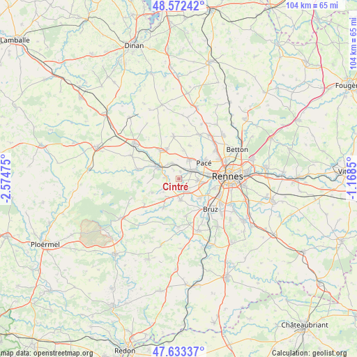
Cintré GPS coordinates[2]
48° 6' 18.144" North, 1° 52' 17.832" West
| Map corner | latitude | longitude |
|---|---|---|
| Upper-left | 48.57242°, | -2.57475° |
| Center: | 48.10504°, | -1.87162° |
| Lower-right: | 47.63337°, | -1.1685° |
| Map W x H: | 104.4×104.4 km | = 64.9×64.9mi |
| max Lat: | 51.07786° ⇑38.8% North |
| Cintré: | 48.10504° |
| min Lat: | ⇓61.2% South 41.3874° |
| min Long | Cintré | max Long |
| -5.08615° | -1.87162° | 9.52242° |
| W 5.6%⇐ | ⇒94.4% E |
Elevation
Elevation of Cintré is 39 m = 128 ft, and this is 154.7 m = 508 ft below average elevation for this country.
| Max E: |
2333 m = 7654 ft | 86.2% |
| Avg. | 193.7 m = 635 ft | |
| Cintré | 39 m = 128 ft | |
Min E: |
-1 m = -3 ft | 13.8% |
See also: France elevation on elevation.city.
Geographical zone
Cintré is located in North temperate zone (between Tropic of Cancer and the Arctic Circle). Distance of this North polar circle is 2052.4 km =1275.3 mi to North.| Distance of | km | miles | from Cintré |
|---|---|---|---|
| North Pole | 4658.3 | 2894.5 | to North |
| Arctic Circle | 2052.4 | 1275.3 | to North |
| Tropic Cancer | 2742.9 | 1704.4 | to South |
| Equator | 5348.8 | 3323.6 | to South |


Nearby cities:
15 places around Cintré: (largest is in red/bold)
• Breteil
4.9 km =3 mi,  335°
335°
• Bréal-sous-Montfort
6.3 km =3.9 mi,  175°
175°
• Chavagne
8.5 km =5.3 mi,  131°
131°
• Clayes
8.4 km =5.2 mi,  9°
9°
• La Chapelle-Thouarault
2.2 km =1.4 mi, 10°
• Le Rheu
5.5 km =3.4 mi,  93°
93°
• Monterfil
9 km =5.6 mi,  242°
242°
• Montfort-sur-Meu
6.9 km =4.3 mi,  299°
299°
• Mordelles
3.9 km =2.4 mi,  146°
146°
• Pacé
8.8 km =5.5 mi,  56°
56°
• Pleumeleuc
9.5 km =5.9 mi, 338°
• Saint-Gilles
6.4 km =4 mi,  32°
32°
• Saint-Thurial
9.5 km =5.9 mi,  207°
207°
• Talensac
4.2 km =2.6 mi,  275°
275°
• Vezin-le-Coquet
8.8 km =5.5 mi,  80°
80°
Sources, notices
• [Note1] Compared only with cities in France existing in our database
• [Src1] Map data: © OpenStreetMap contributors (CC-BY-SA)
• [Src2] Other city data from geonames.org with taken over terms of usage.
• [Src3] Geographical zone / Annual Mean Temperature by Robert A. Rohde @ Wikipedia
