Chivres-Val geodata
Chivres-Val (Hauts-de-France) is a populated place; located in France in Europe/Paris (GMT+2) time zone. With population of 576 people, there are 13727 cities with bigger population in this country. Compared to other cities in France, 87.8% of cities are located further ↓South; 63.6% of cities are located further ←West and 70.1% of cities have higher elevation than Chivres-Val. Note1
Administrative division(s):
- Level 1: Hauts-de-France
- Level 2: Département de l'Aisne
- Level 3: Arrondissement de Soissons
- Level 4: Chivres-Val


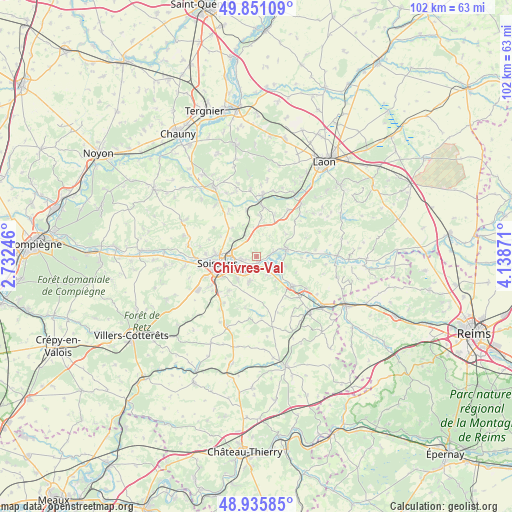
Chivres-Val GPS coordinates[2]
49° 23' 44.16" North, 3° 26' 8.124" East
| Map corner | latitude | longitude |
|---|---|---|
| Upper-left | 49.85109°, | 2.73246° |
| Center: | 49.3956°, | 3.43559° |
| Lower-right: | 48.93585°, | 4.13871° |
| Map W x H: | 101.8×101.8 km | = 63.3×63.3mi |
| max Lat: | 51.07786° ⇑12.2% North |
| Chivres-Val: | 49.3956° |
| min Lat: | ⇓87.8% South 41.3874° |
| min Long | Chivres-Val | max Long |
| -5.08615° | 3.43559° | 9.52242° |
| W 63.6%⇐ | ⇒36.4% E |
Elevation
Elevation of Chivres-Val is 78 m = 256 ft, and this is 115.7 m = 380 ft below average elevation for this country.
| Max E: |
2333 m = 7654 ft | 70.1% |
| Avg. | 193.7 m = 635 ft | |
| Chivres-Val | 78 m = 256 ft | |
Min E: |
-1 m = -3 ft | 29.9% |
See also: France elevation on elevation.city.
Geographical zone
Chivres-Val is located in North temperate zone (between Tropic of Cancer and the Arctic Circle). Distance of this North polar circle is 1908.9 km =1186.1 mi to North.| Distance of | km | miles | from Chivres-Val |
|---|---|---|---|
| North Pole | 4514.8 | 2805.4 | to North |
| Arctic Circle | 1908.9 | 1186.1 | to North |
| Tropic Cancer | 2886.4 | 1793.5 | to South |
| Equator | 5492.3 | 3412.8 | to South |


Nearby cities:
15 places around Chivres-Val: (largest is in red/bold)
• Acy
5.9 km =3.7 mi,  197°
197°
• Belleu
8.3 km =5.2 mi,  240°
240°
• Billy-sur-Aisne
5.8 km =3.6 mi,  220°
220°
• Braine
9.2 km =5.7 mi,  129°
129°
• Bucy-le-Long
2.9 km =1.8 mi,  259°
259°
• Chassemy
5.4 km =3.4 mi,  107°
107°
• Ciry-Salsogne
4.1 km =2.5 mi,  152°
152°
• Crouy
5.6 km =3.5 mi,  278°
278°
• Cuffies
8.3 km =5.2 mi, 276°
• Missy-sur-Aisne
1 km =0.6 mi,  178°
178°
• Septmonts
8.8 km =5.5 mi, 219°
• Soissons
8.3 km =5.2 mi, 259°
• Vailly-sur-Aisne
6 km =3.7 mi,  76°
76°
• Venizel
4.5 km =2.8 mi, 222°
• Villeneuve-Saint-Germain
5.8 km =3.6 mi,  252°
252°
Sources, notices
• [Note1] Compared only with cities in France existing in our database
• [Src1] Map data: © OpenStreetMap contributors (CC-BY-SA)
• [Src2] Other city data from geonames.org with taken over terms of usage.
• [Src3] Geographical zone / Annual Mean Temperature by Robert A. Rohde @ Wikipedia
