Vailly-sur-Aisne geodata
Vailly-sur-Aisne (Hauts-de-France) is a populated place; located in France in Europe/Paris (GMT+2) time zone. With population of 2,133 people, there are 4508 cities with bigger population in this country. Compared to other cities in France, 88% of cities are located further ↓South; 64.4% of cities are located further ←West and 81.8% of cities have higher elevation than Vailly-sur-Aisne. Note1
Administrative division(s):
- Level 1: Hauts-de-France
- Level 2: Département de l'Aisne
- Level 3: Arrondissement de Soissons
- Level 4: Vailly-sur-Aisne


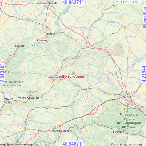
Vailly-sur-Aisne GPS coordinates[2]
49° 24' 30.024" North, 3° 30' 58.716" East
| Map corner | latitude | longitude |
|---|---|---|
| Upper-left | 49.86371°, | 2.81319° |
| Center: | 49.40834°, | 3.51631° |
| Lower-right: | 48.94871°, | 4.21944° |
| Map W x H: | 101.7×101.7 km | = 63.2×63.2mi |
| max Lat: | 51.07786° ⇑12% North |
| Vailly-sur-Aisne: | 49.40834° |
| min Lat: | ⇓88% South 41.3874° |
| min Long | Vailly-sur-Aisn | max Long |
| -5.08615° | 3.51631° | 9.52242° |
| W 64.4%⇐ | ⇒35.6% E |
Elevation
Elevation of Vailly-sur-Aisne is 50 m = 164 ft, and this is 143.7 m = 471 ft below average elevation for this country.
| Max E: |
2333 m = 7654 ft | 81.8% |
| Avg. | 193.7 m = 635 ft | |
| Vailly-sur-Aisne | 50 m = 164 ft | |
Min E: |
-1 m = -3 ft | 18.2% |
See also: France elevation on elevation.city.
Geographical zone
Vailly-sur-Aisne is located in North temperate zone (between Tropic of Cancer and the Arctic Circle). Distance of this North polar circle is 1907.5 km =1185.3 mi to North.| Distance of | km | miles | from Vailly-sur-Aisne |
|---|---|---|---|
| North Pole | 4513.4 | 2804.5 | to North |
| Arctic Circle | 1907.5 | 1185.3 | to North |
| Tropic Cancer | 2887.8 | 1794.4 | to South |
| Equator | 5493.7 | 3413.6 | to South |


Nearby cities:
15 places around Vailly-sur-Aisne: (largest is in red/bold)
• Acy
10.3 km =6.4 mi,  227°
227°
• Billy-sur-Aisne
11.2 km =7 mi,  238°
238°
• Bourg-et-Comin
10.1 km =6.3 mi,  97°
97°
• Braine
7.4 km =4.6 mi,  170°
170°
• Bucy-le-Long
8.9 km =5.5 mi,  257°
257°
• Chassemy
3.2 km =2 mi,  192°
192°
• Chavignon
7.9 km =4.9 mi,  3°
3°
• Chivres-Val
6 km =3.7 mi, 256°
• Ciry-Salsogne
6.4 km =4 mi,  217°
217°
• Crouy
11.4 km =7.1 mi,  266°
266°
• Missy-sur-Aisne
6.3 km =3.9 mi,  247°
247°
• Pinon
10.3 km =6.4 mi,  330°
330°
• Urcel
9.8 km =6.1 mi,  17°
17°
• Venizel
10.1 km =6.3 mi, 242°
• Villeneuve-Saint-Germain
11.8 km =7.3 mi, 254°
Sources, notices
• [Note1] Compared only with cities in France existing in our database
• [Src1] Map data: © OpenStreetMap contributors (CC-BY-SA)
• [Src2] Other city data from geonames.org with taken over terms of usage.
• [Src3] Geographical zone / Annual Mean Temperature by Robert A. Rohde @ Wikipedia
