Chenevières geodata
Chenevières (Grand Est) is a populated place; located in France in Europe/Paris (GMT+2) time zone. With population of 686 people, there are 12000 cities with bigger population in this country. Compared to other cities in France, 68.8% of cities are located further ↓South; 92.5% of cities are located further ←West and 76.4% of cities have lower elevation than Chenevières. Note1
Administrative division(s):
- Level 1: Grand Est
- Level 2: Meurthe-et-Moselle
- Level 3: Arrondissement de Lunéville
- Level 4: Chenevières


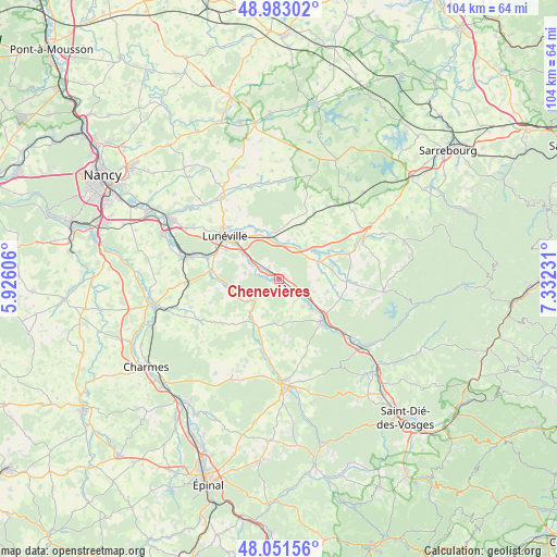
Chenevières GPS coordinates[2]
48° 31' 9.948" North, 6° 37' 45.084" East
| Map corner | latitude | longitude |
|---|---|---|
| Upper-left | 48.98302°, | 5.92606° |
| Center: | 48.51943°, | 6.62919° |
| Lower-right: | 48.05156°, | 7.33231° |
| Map W x H: | 103.6×103.6 km | = 64.4×64.4mi |
| max Lat: | 51.07786° ⇑31.2% North |
| Chenevières: | 48.51943° |
| min Lat: | ⇓68.8% South 41.3874° |
| min Long | Chenevières | max Long |
| -5.08615° | 6.62919° | 9.52242° |
| W 92.5%⇐ | ⇒7.5% E |
Elevation
Elevation of Chenevières is 259 m = 850 ft, and this is 65.3 m = 214 ft above average elevation for this country.
| Max E: |
2333 m = 7654 ft | 23.6% |
| Chenevières | 259 m 850 ft | |
| Avg. | 193.7 m = 635 ft | |
Min E: |
-1 m = -3 ft | 76.4% |
See also: France elevation on elevation.city.
Geographical zone
Chenevières is located in North temperate zone (between Tropic of Cancer and the Arctic Circle). Distance of this North polar circle is 2006.3 km =1246.7 mi to North.| Distance of | km | miles | from Chenevières |
|---|---|---|---|
| North Pole | 4612.2 | 2865.9 | to North |
| Arctic Circle | 2006.3 | 1246.7 | to North |
| Tropic Cancer | 2788.9 | 1732.9 | to South |
| Equator | 5394.9 | 3352.2 | to South |


Nearby cities:
15 places around Chenevières: (largest is in red/bold)
• Azerailles
5.9 km =3.7 mi,  125°
125°
• Baccarat
11.2 km =7 mi, 133°
• Bénaménil
6.5 km =4 mi,  28°
28°
• Chanteheux
11.4 km =7.1 mi,  319°
319°
• Croismare
9.8 km =6.1 mi,  333°
333°
• Damelevières
18.5 km =11.5 mi,  283°
283°
• Gerbéviller
9.1 km =5.7 mi,  253°
253°
• Hériménil
11.2 km =7 mi,  298°
298°
• Jolivet
13.4 km =8.3 mi, 316°
• Lunéville
12.9 km =8 mi,  309°
309°
• Marainviller
8 km =5 mi,  344°
344°
• Mont-sur-Meurthe
14.4 km =8.9 mi,  286°
286°
• Moyen
5.9 km =3.7 mi,  228°
228°
• Rehainviller
12.6 km =7.8 mi, 292°
• Saint-Clément
2.3 km =1.4 mi, 303°
Sources, notices
• [Note1] Compared only with cities in France existing in our database
• [Src1] Map data: © OpenStreetMap contributors (CC-BY-SA)
• [Src2] Other city data from geonames.org with taken over terms of usage.
• [Src3] Geographical zone / Annual Mean Temperature by Robert A. Rohde @ Wikipedia
