Chaudon geodata
Chaudon (Centre) is a populated place; located in France in Europe/Paris (GMT+2) time zone. With population of 1,461 people, there are 6329 cities with bigger population in this country. Compared to other cities in France, 72.3% of cities are located further ↓South; 63.1% of cities are located further →East and 64% of cities have higher elevation than Chaudon. Note1
Administrative division(s):
- Level 1: Centre
- Level 2: Département d'Eure-et-Loir
- Level 3: Arrondissement de Dreux
- Level 4: Chaudon


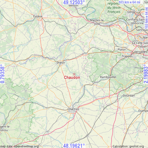
Chaudon GPS coordinates[2]
48° 39' 45.936" North, 1° 29' 48.12" East
| Map corner | latitude | longitude |
|---|---|---|
| Upper-left | 49.12503°, | 0.79358° |
| Center: | 48.66276°, | 1.4967° |
| Lower-right: | 48.19621°, | 2.19983° |
| Map W x H: | 103.3×103.3 km | = 64.2×64.2mi |
| max Lat: | 51.07786° ⇑27.7% North |
| Chaudon: | 48.66276° |
| min Lat: | ⇓72.3% South 41.3874° |
| min Long | Chaudon | max Long |
| -5.08615° | 1.4967° | 9.52242° |
| W 36.9%⇐ | ⇒63.1% E |
Elevation
Elevation of Chaudon is 92 m = 302 ft, and this is 101.7 m = 334 ft below average elevation for this country.
| Max E: |
2333 m = 7654 ft | 64% |
| Avg. | 193.7 m = 635 ft | |
| Chaudon | 92 m = 302 ft | |
Min E: |
-1 m = -3 ft | 36% |
See also: France elevation on elevation.city.
Geographical zone
Chaudon is located in North temperate zone (between Tropic of Cancer and the Arctic Circle). Distance of this North polar circle is 1990.4 km =1236.8 mi to North.| Distance of | km | miles | from Chaudon |
|---|---|---|---|
| North Pole | 4596.3 | 2856 | to North |
| Arctic Circle | 1990.4 | 1236.8 | to North |
| Tropic Cancer | 2804.9 | 1742.9 | to South |
| Equator | 5410.8 | 3362.1 | to South |


Nearby cities:
15 places around Chaudon: (largest is in red/bold)
• Broué
9.8 km =6.1 mi,  11°
11°
• Charpont
6 km =3.7 mi,  312°
312°
• Coulombs
3.8 km =2.4 mi,  107°
107°
• Lormaye
3.1 km =1.9 mi,  118°
118°
• Luray
9.6 km =6 mi, 311°
• Maintenon
10.3 km =6.4 mi,  144°
144°
• Marville-Moutiers-Brûlé
7.1 km =4.4 mi,  273°
273°
• Mézières-en-Drouais
8.6 km =5.3 mi,  322°
322°
• Nogent-le-Roi
2.9 km =1.8 mi, 124°
• Ouerre
4.8 km =3 mi,  331°
331°
• Pierres
9.3 km =5.8 mi,  147°
147°
• Saint-Martin-de-Nigelles
10 km =6.2 mi, 124°
• Senantes
5.2 km =3.2 mi,  85°
85°
• Villemeux-sur-Eure
2.6 km =1.6 mi,  294°
294°
• Villiers-le-Morhier
6.8 km =4.2 mi,  133°
133°
Sources, notices
• [Note1] Compared only with cities in France existing in our database
• [Src1] Map data: © OpenStreetMap contributors (CC-BY-SA)
• [Src2] Other city data from geonames.org with taken over terms of usage.
• [Src3] Geographical zone / Annual Mean Temperature by Robert A. Rohde @ Wikipedia
