Chatuzange-le-Goubet geodata
Chatuzange-le-Goubet (Auvergne-Rhône-Alpes) is a populated place; located in France in Europe/Paris (GMT+2) time zone. With population of 4,278 people, there are 2304 cities with bigger population in this country. Compared to other cities in France, 79.6% of cities are located further ↑North; 78.6% of cities are located further ←West and 72% of cities have lower elevation than Chatuzange-le-Goubet. Note1
Administrative division(s):
- Level 1: Auvergne-Rhône-Alpes
- Level 2: Département de la Drôme
- Level 3: Arrondissement de Valence
- Level 4: Chatuzange-le-Goubet


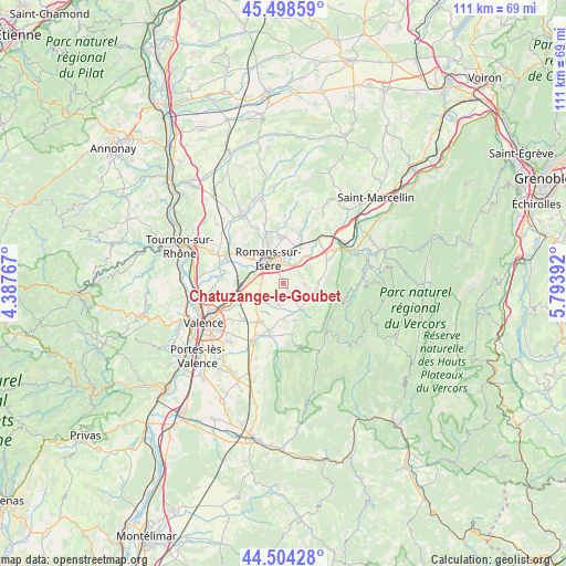
Chatuzange-le-Goubet GPS coordinates[2]
45° 0' 12.924" North, 5° 5' 26.844" East
| Map corner | latitude | longitude |
|---|---|---|
| Upper-left | 45.49859°, | 4.38767° |
| Center: | 45.00359°, | 5.09079° |
| Lower-right: | 44.50428°, | 5.79392° |
| Map W x H: | 110.6×110.6 km | = 68.7×68.7mi |
| max Lat: | 51.07786° ⇑79.6% North |
| Chatuzange-le-Goubet: | 45.00359° |
| min Lat: | ⇓20.4% South 41.3874° |
| min Long | Chatuzange-le-G | max Long |
| -5.08615° | 5.09079° | 9.52242° |
| W 78.6%⇐ | ⇒21.4% E |
Elevation
Elevation of Chatuzange-le-Goubet is 230 m = 755 ft, and this is 36.3 m = 119 ft above average elevation for this country.
| Max E: |
2333 m = 7654 ft | 28% |
| Chatuzange-le-Goubet | 230 m 755 ft | |
| Avg. | 193.7 m = 635 ft | |
Min E: |
-1 m = -3 ft | 72% |
See also: France elevation on elevation.city.
Geographical zone
Chatuzange-le-Goubet is located in North temperate zone (between Tropic of Cancer and the Arctic Circle). Distance of this North polar circle is 2397.2 km =1489.6 mi to North.| Distance of | km | miles | from Chatuzange-le-Goubet |
|---|---|---|---|
| North Pole | 5003.1 | 3108.8 | to North |
| Arctic Circle | 2397.2 | 1489.6 | to North |
| Tropic Cancer | 2398 | 1490 | to South |
| Equator | 5003.9 | 3109.3 | to South |


Nearby cities:
15 places around Chatuzange-le-Goubet: (largest is in red/bold)
• Alixan
5.9 km =3.7 mi,  236°
236°
• Barbières
6.3 km =3.9 mi,  143°
143°
• Beauregard
7.6 km =4.7 mi,  95°
95°
• Bourg-de-Péage
4.5 km =2.8 mi,  314°
314°
• Bésayes
4.3 km =2.7 mi,  195°
195°
• Charpey
7.3 km =4.5 mi,  178°
178°
• Génissieux
9 km =5.6 mi,  355°
355°
• Hostun
9.2 km =5.7 mi,  68°
68°
• Jaillans
7.2 km =4.5 mi, 66°
• Marches
3.4 km =2.1 mi,  156°
156°
• Montélier
9 km =5.6 mi,  211°
211°
• Mours-Saint-Eusèbe
7.3 km =4.5 mi,  339°
339°
• Rochefort-Samson
5.9 km =3.7 mi,  127°
127°
• Romans-sur-Isère
5.5 km =3.4 mi, 339°
• Saint-Paul-lès-Romans
7.8 km =4.8 mi,  24°
24°
Sources, notices
• [Note1] Compared only with cities in France existing in our database
• [Src1] Map data: © OpenStreetMap contributors (CC-BY-SA)
• [Src2] Other city data from geonames.org with taken over terms of usage.
• [Src3] Geographical zone / Annual Mean Temperature by Robert A. Rohde @ Wikipedia
