Beauregard geodata
Beauregard (Auvergne-Rhône-Alpes) is a populated place; located in France in Europe/Paris (GMT+2) time zone. With population of 587 people, there are 13526 cities with bigger population in this country. Compared to other cities in France, 79.7% of cities are located further ↑North; 79.7% of cities are located further ←West and 94.2% of cities have lower elevation than Beauregard. Note1
Administrative division(s):
- Level 1: Auvergne-Rhône-Alpes
- Level 2: Département de la Drôme
- Level 3: Arrondissement de Valence
- Level 4: Beauregard-Baret


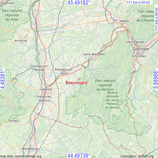
Beauregard GPS coordinates[2]
44° 59' 48.336" North, 5° 11' 12.228" East
| Map corner | latitude | longitude |
|---|---|---|
| Upper-left | 45.49182°, | 4.48361° |
| Center: | 44.99676°, | 5.18673° |
| Lower-right: | 44.49739°, | 5.88986° |
| Map W x H: | 110.6×110.6 km | = 68.7×68.7mi |
| max Lat: | 51.07786° ⇑79.7% North |
| Beauregard: | 44.99676° |
| min Lat: | ⇓20.3% South 41.3874° |
| min Long | Beauregard | max Long |
| -5.08615° | 5.18673° | 9.52242° |
| W 79.7%⇐ | ⇒20.3% E |
Elevation
Elevation of Beauregard is 549 m = 1801 ft, and this is 355.3 m = 1166 ft above average elevation for this country.
| Max E: |
2333 m = 7654 ft | 5.8% |
| Beauregard | 549 m 1801 ft | |
| Avg. | 193.7 m = 635 ft | |
Min E: |
-1 m = -3 ft | 94.2% |
See also: France elevation on elevation.city.
Geographical zone
Beauregard is located in North temperate zone (between Tropic of Cancer and the Arctic Circle). Distance of this Northern Tropic circle is 2397.3 km =1489.6 mi to South.| Distance of | km | miles | from Beauregard |
|---|---|---|---|
| North Pole | 5003.9 | 3109.3 | to North |
| Arctic Circle | 2398 | 1490 | to North |
| Tropic Cancer | 2397.3 | 1489.6 | to South |
| Equator | 5003.2 | 3108.8 | to South |


Nearby cities:
15 places around Beauregard: (largest is in red/bold)
• Barbières
5.7 km =3.5 mi,  221°
221°
• Bésayes
9.3 km =5.8 mi,  248°
248°
• Charpey
9.8 km =6.1 mi,  228°
228°
• Chatuzange-le-Goubet
7.6 km =4.7 mi,  275°
275°
• Châtillon-Saint-Jean
11 km =6.8 mi,  335°
335°
• Eymeux
8.9 km =5.5 mi,  355°
355°
• Hostun
4.2 km =2.6 mi,  14°
14°
• Jaillans
3.8 km =2.4 mi, 344°
• Marches
6.6 km =4.1 mi, 248°
• Rochefort-Samson
4 km =2.5 mi, 224°
• Saint-Jean-en-Royans
8.7 km =5.4 mi,  72°
72°
• Saint-Lattier
10.2 km =6.3 mi, 7°
• Saint-Nazaire-en-Royans
8.6 km =5.3 mi,  34°
34°
• Saint-Paul-lès-Romans
8.9 km =5.5 mi,  331°
331°
• Saint-Thomas-en-Royans
10.3 km =6.4 mi,  55°
55°
Sources, notices
• [Note1] Compared only with cities in France existing in our database
• [Src1] Map data: © OpenStreetMap contributors (CC-BY-SA)
• [Src2] Other city data from geonames.org with taken over terms of usage.
• [Src3] Geographical zone / Annual Mean Temperature by Robert A. Rohde @ Wikipedia
