Mours-Saint-Eusèbe geodata
Mours-Saint-Eusèbe (Auvergne-Rhône-Alpes) is a populated place; located in France in Europe/Paris (GMT+2) time zone. With population of 2,368 people, there are 4083 cities with bigger population in this country. Compared to other cities in France, 78.9% of cities are located further ↑North; 78.2% of cities are located further ←West and 61.3% of cities have lower elevation than Mours-Saint-Eusèbe. Note1
Administrative division(s):
- Level 1: Auvergne-Rhône-Alpes
- Level 2: Département de la Drôme
- Level 3: Arrondissement de Valence
- Level 4: Mours-Saint-Eusèbe


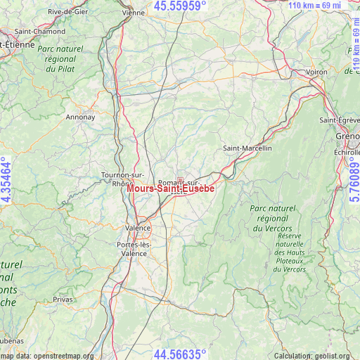
Mours-Saint-Eusèbe GPS coordinates[2]
45° 3' 54.468" North, 5° 3' 27.936" East
| Map corner | latitude | longitude |
|---|---|---|
| Upper-left | 45.55959°, | 4.35464° |
| Center: | 45.06513°, | 5.05776° |
| Lower-right: | 44.56635°, | 5.76089° |
| Map W x H: | 110.4×110.4 km | = 68.6×68.6mi |
| max Lat: | 51.07786° ⇑78.9% North |
| Mours-Saint-Eusèbe: | 45.06513° |
| min Lat: | ⇓21.1% South 41.3874° |
| min Long | Mours-Saint-Eus | max Long |
| -5.08615° | 5.05776° | 9.52242° |
| W 78.2%⇐ | ⇒21.8% E |
Elevation
Elevation of Mours-Saint-Eusèbe is 176 m = 577 ft, and this is 17.7 m = 58 ft below average elevation for this country.
| Max E: |
2333 m = 7654 ft | 38.7% |
| Avg. | 193.7 m = 635 ft | |
| Mours-Saint-Eusèbe | 176 m = 577 ft | |
Min E: |
-1 m = -3 ft | 61.3% |
See also: France elevation on elevation.city.
Geographical zone
Mours-Saint-Eusèbe is located in North temperate zone (between Tropic of Cancer and the Arctic Circle). Distance of this North polar circle is 2390.4 km =1485.3 mi to North.| Distance of | km | miles | from Mours-Saint-Eusèbe |
|---|---|---|---|
| North Pole | 4996.3 | 3104.6 | to North |
| Arctic Circle | 2390.4 | 1485.3 | to North |
| Tropic Cancer | 2404.9 | 1494.3 | to South |
| Equator | 5010.8 | 3113.6 | to South |


Nearby cities:
15 places around Mours-Saint-Eusèbe: (largest is in red/bold)
• Alixan
10.4 km =6.5 mi,  192°
192°
• Bourg-de-Péage
3.8 km =2.4 mi, 189°
• Chatuzange-le-Goubet
7.3 km =4.5 mi,  159°
159°
• Châtillon-Saint-Jean
6.2 km =3.9 mi,  66°
66°
• Clérieux
7.8 km =4.8 mi,  278°
278°
• Eymeux
9.6 km =6 mi,  82°
82°
• Geyssans
6.7 km =4.2 mi,  23°
23°
• Génissieux
2.8 km =1.7 mi,  41°
41°
• Jaillans
10 km =6.2 mi,  113°
113°
• Margès
9.2 km =5.7 mi,  350°
350°
• Parnans
8.3 km =5.2 mi,  53°
53°
• Peyrins
3.3 km =2.1 mi,  342°
342°
• Romans-sur-Isère
1.8 km =1.1 mi, 159°
• Saint-Bardoux
7 km =4.3 mi,  292°
292°
• Saint-Paul-lès-Romans
5.8 km =3.6 mi,  87°
87°
Sources, notices
• [Note1] Compared only with cities in France existing in our database
• [Src1] Map data: © OpenStreetMap contributors (CC-BY-SA)
• [Src2] Other city data from geonames.org with taken over terms of usage.
• [Src3] Geographical zone / Annual Mean Temperature by Robert A. Rohde @ Wikipedia
