Châtillon-sur-Marne geodata
Châtillon-sur-Marne (Grand Est) is a populated place; located in France in Europe/Paris (GMT+2) time zone. With population of 1,009 people, there are 8775 cities with bigger population in this country. Compared to other cities in France, 82.2% of cities are located further ↓South; 66.1% of cities are located further ←West and 52.5% of cities have lower elevation than Châtillon-sur-Marne. Note1
Administrative division(s):
- Level 1: Grand Est
- Level 2: Marne
- Level 3: Arrondissement d'Épernay
- Level 4: Châtillon-sur-Marne


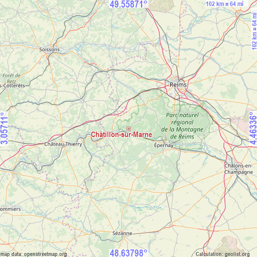
Châtillon-sur-Marne GPS coordinates[2]
49° 6' 1.728" North, 3° 45' 36.828" East
| Map corner | latitude | longitude |
|---|---|---|
| Upper-left | 49.55871°, | 3.05711° |
| Center: | 49.10048°, | 3.76023° |
| Lower-right: | 48.63798°, | 4.46336° |
| Map W x H: | 102.4×102.4 km | = 63.6×63.6mi |
| max Lat: | 51.07786° ⇑17.8% North |
| Châtillon-sur-Marne: | 49.10048° |
| min Lat: | ⇓82.2% South 41.3874° |
| min Long | Châtillon-sur- | max Long |
| -5.08615° | 3.76023° | 9.52242° |
| W 66.1%⇐ | ⇒33.9% E |
Elevation
Elevation of Châtillon-sur-Marne is 141 m = 463 ft, and this is 52.7 m = 173 ft below average elevation for this country.
| Max E: |
2333 m = 7654 ft | 47.5% |
| Avg. | 193.7 m = 635 ft | |
| Châtillon-sur-Marne | 141 m = 463 ft | |
Min E: |
-1 m = -3 ft | 52.5% |
See also: France elevation on elevation.city.
Geographical zone
Châtillon-sur-Marne is located in North temperate zone (between Tropic of Cancer and the Arctic Circle). Distance of this North polar circle is 1941.7 km =1206.5 mi to North.| Distance of | km | miles | from Châtillon-sur-Marne |
|---|---|---|---|
| North Pole | 4547.6 | 2825.7 | to North |
| Arctic Circle | 1941.7 | 1206.5 | to North |
| Tropic Cancer | 2853.5 | 1773.1 | to South |
| Equator | 5459.5 | 3392.4 | to South |


Nearby cities:
15 places around Châtillon-sur-Marne: (largest is in red/bold)
• Boursault
7.6 km =4.7 mi,  125°
125°
• Cumières
12.6 km =7.8 mi,  104°
104°
• Damery
9.3 km =5.8 mi,  109°
109°
• Dormans
9.4 km =5.8 mi,  251°
251°
• Fleury-la-Rivière
9 km =5.6 mi,  92°
92°
• Hautvillers
13.6 km =8.5 mi, 98°
• Mardeuil
13.4 km =8.3 mi, 112°
• Mareuil-le-Port
2.1 km =1.3 mi,  180°
180°
• Port à Binson
2.1 km =1.3 mi, 180°
• Troissy
4.2 km =2.6 mi,  239°
239°
• Venteuil
6.2 km =3.9 mi, 109°
• Verneuil
6.3 km =3.9 mi,  266°
266°
• Ville-en-Tardenois
9.4 km =5.8 mi,  17°
17°
• Vinay
14.2 km =8.8 mi, 134°
• Œuilly
4.7 km =2.9 mi,  142°
142°
Sources, notices
• [Note1] Compared only with cities in France existing in our database
• [Src1] Map data: © OpenStreetMap contributors (CC-BY-SA)
• [Src2] Other city data from geonames.org with taken over terms of usage.
• [Src3] Geographical zone / Annual Mean Temperature by Robert A. Rohde @ Wikipedia
