Boursault geodata
Boursault (Grand Est) is a populated place; located in France in Europe/Paris (GMT+2) time zone. With population of 511 people, there are 15016 cities with bigger population in this country. Compared to other cities in France, 81.1% of cities are located further ↓South; 66.6% of cities are located further ←West and 56.1% of cities have lower elevation than Boursault. Note1
Administrative division(s):
- Level 1: Grand Est
- Level 2: Marne
- Level 3: Arrondissement d'Épernay
- Level 4: Boursault


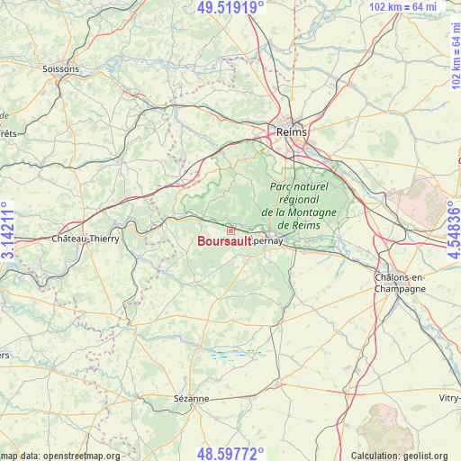
Boursault GPS coordinates[2]
49° 3' 38.124" North, 3° 50' 42.864" East
| Map corner | latitude | longitude |
|---|---|---|
| Upper-left | 49.51919°, | 3.14211° |
| Center: | 49.06059°, | 3.84524° |
| Lower-right: | 48.59772°, | 4.54836° |
| Map W x H: | 102.5×102.5 km | = 63.7×63.7mi |
| max Lat: | 51.07786° ⇑18.9% North |
| Boursault: | 49.06059° |
| min Lat: | ⇓81.1% South 41.3874° |
| min Long | Boursault | max Long |
| -5.08615° | 3.84524° | 9.52242° |
| W 66.6%⇐ | ⇒33.4% E |
Elevation
Elevation of Boursault is 154 m = 505 ft, and this is 39.7 m = 130 ft below average elevation for this country.
| Max E: |
2333 m = 7654 ft | 43.9% |
| Avg. | 193.7 m = 635 ft | |
| Boursault | 154 m = 505 ft | |
Min E: |
-1 m = -3 ft | 56.1% |
See also: France elevation on elevation.city.
Geographical zone
Boursault is located in North temperate zone (between Tropic of Cancer and the Arctic Circle). Distance of this North polar circle is 1946.1 km =1209.3 mi to North.| Distance of | km | miles | from Boursault |
|---|---|---|---|
| North Pole | 4552 | 2828.5 | to North |
| Arctic Circle | 1946.1 | 1209.3 | to North |
| Tropic Cancer | 2849.1 | 1770.3 | to South |
| Equator | 5455 | 3389.6 | to South |


Nearby cities:
15 places around Boursault: (largest is in red/bold)
• Châtillon-sur-Marne
7.6 km =4.7 mi,  305°
305°
• Cumières
6.1 km =3.8 mi,  77°
77°
• Damery
2.9 km =1.8 mi,  62°
62°
• Dizy
8.9 km =5.5 mi,  85°
85°
• Fleury-la-Rivière
4.9 km =3 mi,  34°
34°
• Hautvillers
7.7 km =4.8 mi,  70°
70°
• Mardeuil
6.2 km =3.9 mi,  96°
96°
• Mareuil-le-Port
6.6 km =4.1 mi,  290°
290°
• Moussy
7.4 km =4.6 mi,  131°
131°
• Pierry
8.3 km =5.2 mi,  122°
122°
• Port à Binson
6.7 km =4.2 mi, 290°
• Venteuil
2.4 km =1.5 mi,  353°
353°
• Vinay
6.8 km =4.2 mi,  144°
144°
• Épernay
8.6 km =5.3 mi,  105°
105°
• Œuilly
3.4 km =2.1 mi,  281°
281°
Sources, notices
• [Note1] Compared only with cities in France existing in our database
• [Src1] Map data: © OpenStreetMap contributors (CC-BY-SA)
• [Src2] Other city data from geonames.org with taken over terms of usage.
• [Src3] Geographical zone / Annual Mean Temperature by Robert A. Rohde @ Wikipedia
