Châteauvilain geodata
Châteauvilain (Auvergne-Rhône-Alpes) is a populated place; located in France in Europe/Paris (GMT+2) time zone. With population of 525 people, there are 14719 cities with bigger population in this country. Compared to other cities in France, 74% of cities are located further ↑North; 80.9% of cities are located further ←West and 93.4% of cities have lower elevation than Châteauvilain. Note1
Administrative division(s):
- Level 1: Auvergne-Rhône-Alpes
- Level 2: Département de l'Isère
- Level 3: Arrondissement de La Tour-du-Pin
- Level 4: Châteauvilain


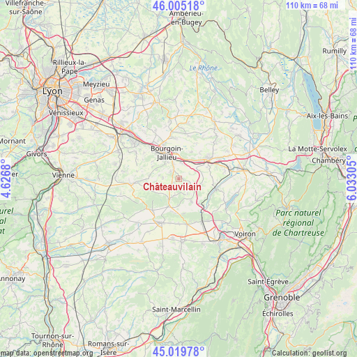
Châteauvilain GPS coordinates[2]
45° 30' 52.704" North, 5° 19' 47.712" East
| Map corner | latitude | longitude |
|---|---|---|
| Upper-left | 46.00518°, | 4.6268° |
| Center: | 45.51464°, | 5.32992° |
| Lower-right: | 45.01978°, | 6.03305° |
| Map W x H: | 109.6×109.6 km | = 68.1×68.1mi |
| max Lat: | 51.07786° ⇑74% North |
| Châteauvilain: | 45.51464° |
| min Lat: | ⇓26% South 41.3874° |
| min Long | Châteauvilain | max Long |
| -5.08615° | 5.32992° | 9.52242° |
| W 80.9%⇐ | ⇒19.1% E |
Elevation
Elevation of Châteauvilain is 520 m = 1706 ft, and this is 326.3 m = 1071 ft above average elevation for this country.
| Max E: |
2333 m = 7654 ft | 6.6% |
| Châteauvilain | 520 m 1706 ft | |
| Avg. | 193.7 m = 635 ft | |
Min E: |
-1 m = -3 ft | 93.4% |
See also: France elevation on elevation.city.
Geographical zone
Châteauvilain is located in North temperate zone (between Tropic of Cancer and the Arctic Circle). Distance of this North polar circle is 2340.4 km =1454.3 mi to North.| Distance of | km | miles | from Châteauvilain |
|---|---|---|---|
| North Pole | 4946.3 | 3073.5 | to North |
| Arctic Circle | 2340.4 | 1454.3 | to North |
| Tropic Cancer | 2454.8 | 1525.3 | to South |
| Equator | 5060.8 | 3144.6 | to South |


Nearby cities:
15 places around Châteauvilain: (largest is in red/bold)
• Badinières
2.2 km =1.4 mi,  250°
250°
• Biol
5 km =3.1 mi,  120°
120°
• Cessieu
6.5 km =4 mi,  33°
33°
• Champier
7.2 km =4.5 mi,  203°
203°
• Culin
6.1 km =3.8 mi,  280°
280°
• Doissin
6.9 km =4.3 mi,  100°
100°
• Eclose
3 km =1.9 mi,  232°
232°
• Les Éparres
3.6 km =2.2 mi,  311°
311°
• Meyrié
5.9 km =3.7 mi,  325°
325°
• Nivolas-Vermelle
5.3 km =3.3 mi,  339°
339°
• Saint-Agnin-sur-Bion
7.8 km =4.8 mi,  290°
290°
• Saint-Victor-de-Cessieu
5.6 km =3.5 mi,  58°
58°
• Succieu
1.5 km =0.9 mi,  24°
24°
• Sérézin-de-la-Tour
4.8 km =3 mi, 16°
• Tramolé
4.8 km =3 mi,  274°
274°
Sources, notices
• [Note1] Compared only with cities in France existing in our database
• [Src1] Map data: © OpenStreetMap contributors (CC-BY-SA)
• [Src2] Other city data from geonames.org with taken over terms of usage.
• [Src3] Geographical zone / Annual Mean Temperature by Robert A. Rohde @ Wikipedia
