Charny geodata
Charny (Île-de-France) is a populated place; located in France in Europe/Paris (GMT+2) time zone. With population of 1,272 people, there are 7168 cities with bigger population in this country. Compared to other cities in France, 79% of cities are located further ↓South; 54.4% of cities are located further ←West and 59.1% of cities have higher elevation than Charny. Note1
Administrative division(s):
- Level 1: Île-de-France
- Level 2: Seine-et-Marne
- Level 3: Arrondissement de Meaux
- Level 4: Charny


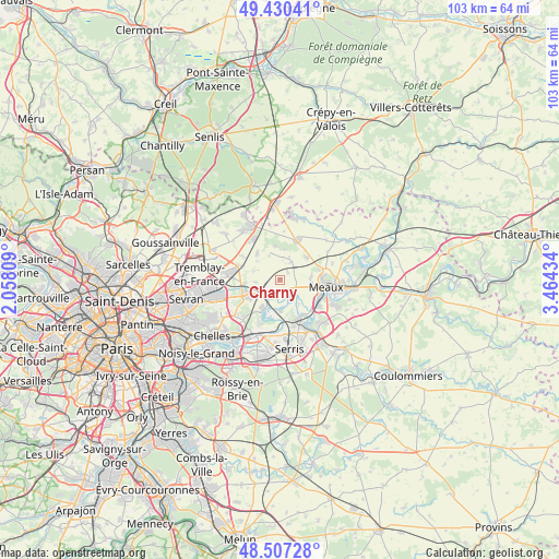
Charny GPS coordinates[2]
48° 58' 15.528" North, 2° 45' 40.356" East
| Map corner | latitude | longitude |
|---|---|---|
| Upper-left | 49.43041°, | 2.05809° |
| Center: | 48.97098°, | 2.76121° |
| Lower-right: | 48.50728°, | 3.46434° |
| Map W x H: | 102.6×102.6 km | = 63.8×63.8mi |
| max Lat: | 51.07786° ⇑21% North |
| Charny: | 48.97098° |
| min Lat: | ⇓79% South 41.3874° |
| min Long | Charny | max Long |
| -5.08615° | 2.76121° | 9.52242° |
| W 54.4%⇐ | ⇒45.6% E |
Elevation
Elevation of Charny is 105 m = 344 ft, and this is 88.7 m = 291 ft below average elevation for this country.
| Max E: |
2333 m = 7654 ft | 59.1% |
| Avg. | 193.7 m = 635 ft | |
| Charny | 105 m = 344 ft | |
Min E: |
-1 m = -3 ft | 40.9% |
See also: France elevation on elevation.city.
Geographical zone
Charny is located in North temperate zone (between Tropic of Cancer and the Arctic Circle). Distance of this North polar circle is 1956.1 km =1215.5 mi to North.| Distance of | km | miles | from Charny |
|---|---|---|---|
| North Pole | 4562 | 2834.7 | to North |
| Arctic Circle | 1956.1 | 1215.5 | to North |
| Tropic Cancer | 2839.1 | 1764.1 | to South |
| Equator | 5445.1 | 3383.4 | to South |


Nearby cities:
15 places around Charny: (largest is in red/bold)
• Annet-sur-Marne
5.8 km =3.6 mi,  211°
211°
• Chauconin-Neufmontiers
6.5 km =4 mi,  94°
94°
• Claye-Souilly
6.2 km =3.9 mi,  242°
242°
• Gressy
6.4 km =4 mi,  263°
263°
• Iverny
3.9 km =2.4 mi,  31°
31°
• Jablines
5.9 km =3.7 mi,  178°
178°
• Juilly
6.2 km =3.9 mi,  319°
319°
• Lesches
7 km =4.3 mi,  167°
167°
• Messy
4.5 km =2.8 mi, 263°
• Montgé-en-Goële
7 km =4.3 mi,  353°
353°
• Monthyon
6.2 km =3.9 mi,  49°
49°
• Précy-sur-Marne
4.6 km =2.9 mi, 167°
• Saint-Mesmes
5.1 km =3.2 mi,  287°
287°
• Trilbardou
4.6 km =2.9 mi,  133°
133°
• Villeroy
2 km =1.2 mi, 48°
Sources, notices
• [Note1] Compared only with cities in France existing in our database
• [Src1] Map data: © OpenStreetMap contributors (CC-BY-SA)
• [Src2] Other city data from geonames.org with taken over terms of usage.
• [Src3] Geographical zone / Annual Mean Temperature by Robert A. Rohde @ Wikipedia
