Monthyon geodata
Monthyon (Île-de-France) is a populated place; located in France in Europe/Paris (GMT+2) time zone. With population of 1,459 people, there are 6335 cities with bigger population in this country. Compared to other cities in France, 79.8% of cities are located further ↓South; 55.3% of cities are located further ←West and 58% of cities have lower elevation than Monthyon. Note1
Administrative division(s):
- Level 1: Île-de-France
- Level 2: Seine-et-Marne
- Level 3: Arrondissement de Meaux
- Level 4: Monthyon


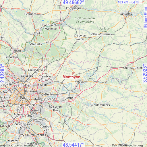
Monthyon GPS coordinates[2]
49° 0' 27.108" North, 2° 49' 33.96" East
| Map corner | latitude | longitude |
|---|---|---|
| Upper-left | 49.46662°, | 2.12298° |
| Center: | 49.00753°, | 2.8261° |
| Lower-right: | 48.54417°, | 3.52923° |
| Map W x H: | 102.6×102.6 km | = 63.8×63.8mi |
| max Lat: | 51.07786° ⇑20.2% North |
| Monthyon: | 49.00753° |
| min Lat: | ⇓79.8% South 41.3874° |
| min Long | Monthyon | max Long |
| -5.08615° | 2.8261° | 9.52242° |
| W 55.3%⇐ | ⇒44.7% E |
Elevation
Elevation of Monthyon is 161 m = 528 ft, and this is 32.7 m = 107 ft below average elevation for this country.
| Max E: |
2333 m = 7654 ft | 42% |
| Avg. | 193.7 m = 635 ft | |
| Monthyon | 161 m = 528 ft | |
Min E: |
-1 m = -3 ft | 58% |
See also: France elevation on elevation.city.
Geographical zone
Monthyon is located in North temperate zone (between Tropic of Cancer and the Arctic Circle). Distance of this North polar circle is 1952 km =1212.9 mi to North.| Distance of | km | miles | from Monthyon |
|---|---|---|---|
| North Pole | 4557.9 | 2832.1 | to North |
| Arctic Circle | 1952 | 1212.9 | to North |
| Tropic Cancer | 2843.2 | 1766.7 | to South |
| Equator | 5449.1 | 3385.9 | to South |


Nearby cities:
15 places around Monthyon: (largest is in red/bold)
• Chambry
5.1 km =3.2 mi,  101°
101°
• Charny
6.2 km =3.9 mi,  229°
229°
• Chauconin-Neufmontiers
4.9 km =3 mi,  159°
159°
• Crégy-lès-Meaux
5 km =3.1 mi,  134°
134°
• Iverny
2.8 km =1.7 mi,  254°
254°
• Meaux
6.5 km =4 mi,  143°
143°
• Montgé-en-Goële
6.2 km =3.9 mi,  297°
297°
• Oissery
7 km =4.3 mi,  355°
355°
• Penchard
3.5 km =2.2 mi, 132°
• Saint-Pathus
7.4 km =4.6 mi,  344°
344°
• Saint-Soupplets
3.7 km =2.3 mi, 338°
• Trilbardou
7.4 km =4.6 mi,  191°
191°
• Varreddes
7.4 km =4.6 mi,  93°
93°
• Villenoy
7.8 km =4.8 mi, 161°
• Villeroy
4.2 km =2.6 mi, 229°
Sources, notices
• [Note1] Compared only with cities in France existing in our database
• [Src1] Map data: © OpenStreetMap contributors (CC-BY-SA)
• [Src2] Other city data from geonames.org with taken over terms of usage.
• [Src3] Geographical zone / Annual Mean Temperature by Robert A. Rohde @ Wikipedia
