Chamberet geodata
Chamberet (Nouvelle-Aquitaine) is a populated place; located in France in Europe/Paris (GMT+2) time zone. With population of 1,330 people, there are 6894 cities with bigger population in this country. Compared to other cities in France, 72.9% of cities are located further ↑North; 60.2% of cities are located further →East and 89.1% of cities have lower elevation than Chamberet. Note1
Administrative division(s):
- Level 1: Nouvelle-Aquitaine
- Level 2: Département de la Corrèze
- Level 3: Arrondissement de Tulle
- Level 4: Chamberet


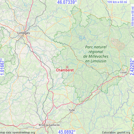
Chamberet GPS coordinates[2]
45° 35' 0.42" North, 1° 43' 11.28" East
| Map corner | latitude | longitude |
|---|---|---|
| Upper-left | 46.07339°, | 1.01667° |
| Center: | 45.58345°, | 1.7198° |
| Lower-right: | 45.0892°, | 2.42292° |
| Map W x H: | 109.4×109.4 km | = 68×68mi |
| max Lat: | 51.07786° ⇑72.9% North |
| Chamberet: | 45.58345° |
| min Lat: | ⇓27.1% South 41.3874° |
| min Long | Chamberet | max Long |
| -5.08615° | 1.7198° | 9.52242° |
| W 39.8%⇐ | ⇒60.2% E |
Elevation
Elevation of Chamberet is 408 m = 1339 ft, and this is 214.3 m = 703 ft above average elevation for this country.
| Max E: |
2333 m = 7654 ft | 10.9% |
| Chamberet | 408 m 1339 ft | |
| Avg. | 193.7 m = 635 ft | |
Min E: |
-1 m = -3 ft | 89.1% |
See also: France elevation on elevation.city.
Geographical zone
Chamberet is located in North temperate zone (between Tropic of Cancer and the Arctic Circle). Distance of this North polar circle is 2332.8 km =1449.5 mi to North.| Distance of | km | miles | from Chamberet |
|---|---|---|---|
| North Pole | 4938.7 | 3068.8 | to North |
| Arctic Circle | 2332.8 | 1449.5 | to North |
| Tropic Cancer | 2462.5 | 1530.1 | to South |
| Equator | 5068.4 | 3149.4 | to South |


Nearby cities:
15 places around Chamberet: (largest is in red/bold)
• Bugeat
16.2 km =10.1 mi,  84°
84°
• Chamboulive
16.9 km =10.5 mi,  184°
184°
• Châteauneuf-la-Forêt
16.9 km =10.5 mi,  328°
328°
• Condat-sur-Ganaveix
16.2 km =10.1 mi,  217°
217°
• Eyburie
15.2 km =9.4 mi,  205°
205°
• Eymoutiers
17.4 km =10.8 mi,  5°
5°
• La Croisille-sur-Briance
11.9 km =7.4 mi,  295°
295°
• La Porcherie
13.7 km =8.5 mi,  268°
268°
• Le Lonzac
13.3 km =8.3 mi, 177°
• Masseret
16.1 km =10 mi,  254°
254°
• Meilhards
6.1 km =3.8 mi,  244°
244°
• Nedde
17.4 km =10.8 mi,  29°
29°
• Neuvic-Entier
17.6 km =10.9 mi, 331°
• Salon-la-Tour
16.6 km =10.3 mi, 238°
• Treignac
7.8 km =4.8 mi,  131°
131°
Sources, notices
• [Note1] Compared only with cities in France existing in our database
• [Src1] Map data: © OpenStreetMap contributors (CC-BY-SA)
• [Src2] Other city data from geonames.org with taken over terms of usage.
• [Src3] Geographical zone / Annual Mean Temperature by Robert A. Rohde @ Wikipedia
