Chalais geodata
Chalais (Nouvelle-Aquitaine) is a populated place; located in France in Europe/Paris (GMT+2) time zone. With population of 1,986 people, there are 4819 cities with bigger population in this country. Compared to other cities in France, 76.6% of cities are located further ↑North; 77.8% of cities are located further →East and 78.2% of cities have higher elevation than Chalais. Note1
Administrative division(s):
- Level 1: Nouvelle-Aquitaine
- Level 2: Charente
- Level 3: Arrondissement d’Angoulême
- Level 4: Chalais


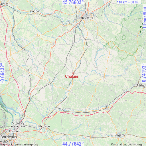
Chalais GPS coordinates[2]
45° 16' 24.168" North, 0° 2' 19.68" East
| Map corner | latitude | longitude |
|---|---|---|
| Upper-left | 45.76603°, | -0.66432° |
| Center: | 45.27338°, | 0.0388° |
| Lower-right: | 44.77642°, | 0.74193° |
| Map W x H: | 110×110 km | = 68.4×68.4mi |
| max Lat: | 51.07786° ⇑76.6% North |
| Chalais: | 45.27338° |
| min Lat: | ⇓23.4% South 41.3874° |
| min Long | Chalais | max Long |
| -5.08615° | 0.0388° | 9.52242° |
| W 22.2%⇐ | ⇒77.8% E |
Elevation
Elevation of Chalais is 59 m = 194 ft, and this is 134.7 m = 442 ft below average elevation for this country.
| Max E: |
2333 m = 7654 ft | 78.2% |
| Avg. | 193.7 m = 635 ft | |
| Chalais | 59 m = 194 ft | |
Min E: |
-1 m = -3 ft | 21.8% |
See also: France elevation on elevation.city.
Geographical zone
Chalais is located in North temperate zone (between Tropic of Cancer and the Arctic Circle). Distance of this North polar circle is 2367.2 km =1470.9 mi to North.| Distance of | km | miles | from Chalais |
|---|---|---|---|
| North Pole | 4973.1 | 3090.1 | to North |
| Arctic Circle | 2367.2 | 1470.9 | to North |
| Tropic Cancer | 2428 | 1508.7 | to South |
| Equator | 5033.9 | 3127.9 | to South |


Nearby cities:
15 places around Chalais: (largest is in red/bold)
• Allemans
20.5 km =12.7 mi,  86°
86°
• Brossac
9.6 km =6 mi,  313°
313°
• Condéon
19.5 km =12.1 mi,  316°
316°
• La Roche-Chalais
13.8 km =8.6 mi,  187°
187°
• Le Fouilloux
15.8 km =9.8 mi,  230°
230°
• Les Églisottes-et-Chalaures
20.4 km =12.7 mi,  197°
197°
• Montguyon
18.5 km =11.5 mi,  250°
250°
• Montmoreau-Saint-Cybard
15.9 km =9.9 mi,  27°
27°
• Saint-Aigulin
13.4 km =8.3 mi, 196°
• Saint-Amant-de-Montmoreau
16.5 km =10.3 mi, 31°
• Saint-Aulaye
11 km =6.8 mi,  137°
137°
• Saint-Privat-des-Prés
14.6 km =9.1 mi,  107°
107°
• Saint-Romain
8.8 km =5.5 mi,  82°
82°
• Saint-Séverin
17.2 km =10.7 mi,  73°
73°
• Vanxains
20.2 km =12.6 mi, 108°
Sources, notices
• [Note1] Compared only with cities in France existing in our database
• [Src1] Map data: © OpenStreetMap contributors (CC-BY-SA)
• [Src2] Other city data from geonames.org with taken over terms of usage.
• [Src3] Geographical zone / Annual Mean Temperature by Robert A. Rohde @ Wikipedia
