Montguyon geodata
Montguyon (Nouvelle-Aquitaine) is a populated place; located in France in Europe/Paris (GMT+2) time zone. With population of 1,572 people, there are 5929 cities with bigger population in this country. Compared to other cities in France, 77.3% of cities are located further ↑North; 79.5% of cities are located further →East and 75% of cities have higher elevation than Montguyon. Note1
Administrative division(s):
- Level 1: Nouvelle-Aquitaine
- Level 2: Charente-Maritime
- Level 3: Arrondissement de Jonzac
- Level 4: Montguyon


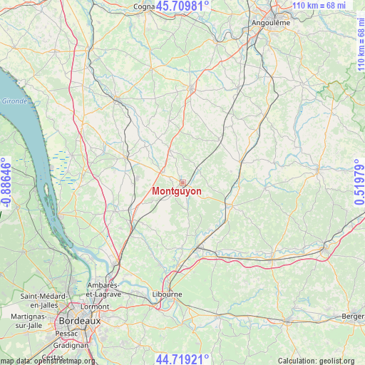
Montguyon GPS coordinates[2]
45° 13' 0.012" North, 0° 10' 59.988" West
| Map corner | latitude | longitude |
|---|---|---|
| Upper-left | 45.70981°, | -0.88646° |
| Center: | 45.21667°, | -0.18333° |
| Lower-right: | 44.71921°, | 0.51979° |
| Map W x H: | 110.1×110.1 km | = 68.4×68.4mi |
| max Lat: | 51.07786° ⇑77.3% North |
| Montguyon: | 45.21667° |
| min Lat: | ⇓22.7% South 41.3874° |
| min Long | Montguyon | max Long |
| -5.08615° | -0.18333° | 9.52242° |
| W 20.5%⇐ | ⇒79.5% E |
Elevation
Elevation of Montguyon is 67 m = 220 ft, and this is 126.7 m = 416 ft below average elevation for this country.
| Max E: |
2333 m = 7654 ft | 75% |
| Avg. | 193.7 m = 635 ft | |
| Montguyon | 67 m = 220 ft | |
Min E: |
-1 m = -3 ft | 25% |
See also: France elevation on elevation.city.
Geographical zone
Montguyon is located in North temperate zone (between Tropic of Cancer and the Arctic Circle). Distance of this North polar circle is 2373.6 km =1474.9 mi to North.| Distance of | km | miles | from Montguyon |
|---|---|---|---|
| North Pole | 4979.4 | 3094.1 | to North |
| Arctic Circle | 2373.6 | 1474.9 | to North |
| Tropic Cancer | 2421.7 | 1504.8 | to South |
| Equator | 5027.6 | 3124 | to South |


Nearby cities:
15 places around Montguyon: (largest is in red/bold)
• Bedenac
10.7 km =6.6 mi,  238°
238°
• Brossac
16.6 km =10.3 mi,  38°
38°
• Bussac-Forêt
14.7 km =9.1 mi,  267°
267°
• Cercoux
9.4 km =5.8 mi,  188°
188°
• Chamadelle
15.9 km =9.9 mi,  144°
144°
• Chepniers
9.9 km =6.2 mi,  292°
292°
• Chevanceaux
10.1 km =6.3 mi,  337°
337°
• Clérac
4.5 km =2.8 mi,  215°
215°
• La Clotte
11.4 km =7.1 mi,  166°
166°
• Laruscade
16.2 km =10.1 mi,  226°
226°
• Le Fouilloux
6.4 km =4 mi,  125°
125°
• Maransin
16.2 km =10.1 mi,  203°
203°
• Montlieu-la-Garde
6.4 km =4 mi,  305°
305°
• Orignolles
4.3 km =2.7 mi,  295°
295°
• Saint-Aigulin
15.2 km =9.4 mi,  115°
115°
Sources, notices
• [Note1] Compared only with cities in France existing in our database
• [Src1] Map data: © OpenStreetMap contributors (CC-BY-SA)
• [Src2] Other city data from geonames.org with taken over terms of usage.
• [Src3] Geographical zone / Annual Mean Temperature by Robert A. Rohde @ Wikipedia
