Brossac geodata
Brossac (Nouvelle-Aquitaine) is a populated place; located in France in Europe/Paris (GMT+2) time zone. With population of 546 people, there are 14284 cities with bigger population in this country. Compared to other cities in France, 76% of cities are located further ↑North; 78.5% of cities are located further →East and 59.6% of cities have lower elevation than Brossac. Note1
Administrative division(s):
- Level 1: Nouvelle-Aquitaine
- Level 2: Charente
- Level 3: Arrondissement de Cognac
- Level 4: Brossac


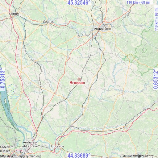
Brossac GPS coordinates[2]
45° 19' 59.988" North, 0° 3' 0" West
| Map corner | latitude | longitude |
|---|---|---|
| Upper-left | 45.82546°, | -0.75313° |
| Center: | 45.33333°, | -0.05° |
| Lower-right: | 44.83689°, | 0.65312° |
| Map W x H: | 109.9×109.9 km | = 68.3×68.3mi |
| max Lat: | 51.07786° ⇑76% North |
| Brossac: | 45.33333° |
| min Lat: | ⇓24% South 41.3874° |
| min Long | Brossac | max Long |
| -5.08615° | -0.05° | 9.52242° |
| W 21.5%⇐ | ⇒78.5% E |
Elevation
Elevation of Brossac is 168 m = 551 ft, and this is 25.7 m = 84 ft below average elevation for this country.
| Max E: |
2333 m = 7654 ft | 40.4% |
| Avg. | 193.7 m = 635 ft | |
| Brossac | 168 m = 551 ft | |
Min E: |
-1 m = -3 ft | 59.6% |
See also: France elevation on elevation.city.
Geographical zone
Brossac is located in North temperate zone (between Tropic of Cancer and the Arctic Circle). Distance of this North polar circle is 2360.6 km =1466.8 mi to North.| Distance of | km | miles | from Brossac |
|---|---|---|---|
| North Pole | 4966.5 | 3086 | to North |
| Arctic Circle | 2360.6 | 1466.8 | to North |
| Tropic Cancer | 2434.7 | 1512.9 | to South |
| Equator | 5040.6 | 3132.1 | to South |


Nearby cities:
15 places around Brossac: (largest is in red/bold)
• Baignes-Sainte-Radegonde
15.4 km =9.6 mi,  291°
291°
• Barbezieux-Saint-Hilaire
17.4 km =10.8 mi,  332°
332°
• Blanzac-Porcheresse
17.9 km =11.1 mi,  21°
21°
• Chalais
9.6 km =6 mi,  133°
133°
• Chevanceaux
14.8 km =9.2 mi,  255°
255°
• Condéon
9.9 km =6.2 mi,  318°
318°
• Le Fouilloux
17.5 km =10.9 mi,  197°
197°
• Montchaude
17.5 km =10.9 mi, 317°
• Montguyon
16.6 km =10.3 mi,  218°
218°
• Montmoreau-Saint-Cybard
16.1 km =10 mi,  62°
62°
• Orignolles
18.1 km =11.2 mi,  232°
232°
• Reignac
13 km =8.1 mi, 315°
• Saint-Amant-de-Montmoreau
17.3 km =10.7 mi, 64°
• Saint-Romain
16.6 km =10.3 mi,  109°
109°
• Touvérac
13 km =8.1 mi,  295°
295°
Sources, notices
• [Note1] Compared only with cities in France existing in our database
• [Src1] Map data: © OpenStreetMap contributors (CC-BY-SA)
• [Src2] Other city data from geonames.org with taken over terms of usage.
• [Src3] Geographical zone / Annual Mean Temperature by Robert A. Rohde @ Wikipedia
