Caudecoste geodata
Caudecoste (Nouvelle-Aquitaine) is a populated place; located in France in Europe/Paris (GMT+2) time zone. With population of 912 people, there are 9558 cities with bigger population in this country. Compared to other cities in France, 86.1% of cities are located further ↑North; 71.1% of cities are located further →East and 70.5% of cities have higher elevation than Caudecoste. Note1
Administrative division(s):
- Level 1: Nouvelle-Aquitaine
- Level 2: Département du Lot-et-Garonne
- Level 3: Agen
- Level 4: Caudecoste


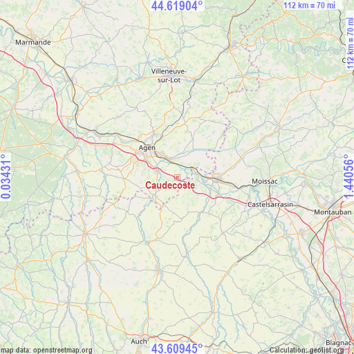
Caudecoste GPS coordinates[2]
44° 6' 59.04" North, 0° 44' 14.784" East
| Map corner | latitude | longitude |
|---|---|---|
| Upper-left | 44.61904°, | 0.03431° |
| Center: | 44.1164°, | 0.73744° |
| Lower-right: | 43.60945°, | 1.44056° |
| Map W x H: | 112.3×112.3 km | = 69.8×69.8mi |
| max Lat: | 51.07786° ⇑86.1% North |
| Caudecoste: | 44.1164° |
| min Lat: | ⇓13.9% South 41.3874° |
| min Long | Caudecoste | max Long |
| -5.08615° | 0.73744° | 9.52242° |
| W 28.9%⇐ | ⇒71.1% E |
Elevation
Elevation of Caudecoste is 77 m = 253 ft, and this is 116.7 m = 383 ft below average elevation for this country.
| Max E: |
2333 m = 7654 ft | 70.5% |
| Avg. | 193.7 m = 635 ft | |
| Caudecoste | 77 m = 253 ft | |
Min E: |
-1 m = -3 ft | 29.5% |
See also: France elevation on elevation.city.
Geographical zone
Caudecoste is located in North temperate zone (between Tropic of Cancer and the Arctic Circle). Distance of this Northern Tropic circle is 2299.4 km =1428.8 mi to South.| Distance of | km | miles | from Caudecoste |
|---|---|---|---|
| North Pole | 5101.8 | 3170.1 | to North |
| Arctic Circle | 2495.9 | 1550.9 | to North |
| Tropic Cancer | 2299.4 | 1428.8 | to South |
| Equator | 4905.3 | 3048 | to South |


Nearby cities:
15 places around Caudecoste: (largest is in red/bold)
• Agen
12.8 km =8 mi,  316°
316°
• Astaffort
9 km =5.6 mi,  229°
229°
• Bon-Encontre
9.5 km =5.9 mi, 323°
• Boé
9.9 km =6.2 mi,  299°
299°
• Castelculier
7.5 km =4.7 mi,  330°
330°
• Donzac
6.6 km =4.1 mi,  95°
95°
• Dunes
4.1 km =2.5 mi,  139°
139°
• Golfech
9.2 km =5.7 mi,  91°
91°
• Lafox
6 km =3.7 mi,  335°
335°
• Lamagistère
7 km =4.3 mi,  82°
82°
• Layrac
6.4 km =4 mi,  288°
288°
• Miradoux
13.2 km =8.2 mi,  173°
173°
• Puymirol
9.2 km =5.7 mi,  30°
30°
• Saint-Pierre-de-Clairac
7.3 km =4.5 mi,  15°
15°
• Valence
12.3 km =7.6 mi, 94°
Sources, notices
• [Note1] Compared only with cities in France existing in our database
• [Src1] Map data: © OpenStreetMap contributors (CC-BY-SA)
• [Src2] Other city data from geonames.org with taken over terms of usage.
• [Src3] Geographical zone / Annual Mean Temperature by Robert A. Rohde @ Wikipedia
