Valence geodata
Valence (Occitanie) is a populated place; located in France in Europe/Paris (GMT+2) time zone. With population of 5,039 people, there are 1963 cities with bigger population in this country. Compared to other cities in France, 86.2% of cities are located further ↑North; 69.8% of cities are located further →East and 73.1% of cities have higher elevation than Valence. Note1
Administrative division(s):
- Level 1: Occitanie
- Level 2: Département du Tarn-et-Garonne
- Level 3: Arrondissement de Castelsarrasin
- Level 4: Valence


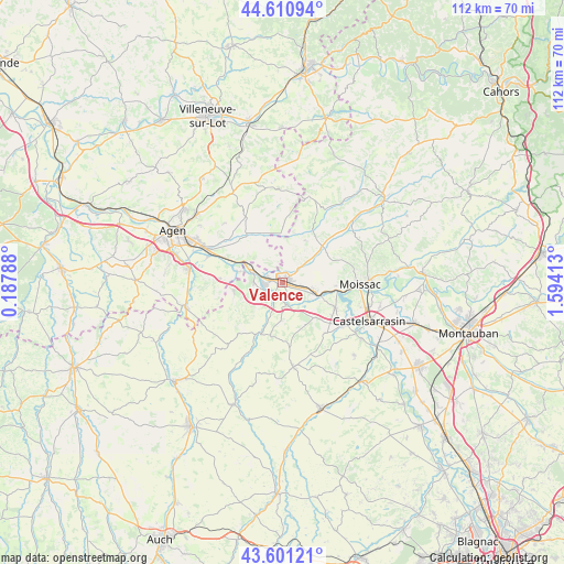
Valence GPS coordinates[2]
44° 6' 29.628" North, 0° 53' 27.636" East
| Map corner | latitude | longitude |
|---|---|---|
| Upper-left | 44.61094°, | 0.18788° |
| Center: | 44.10823°, | 0.89101° |
| Lower-right: | 43.60121°, | 1.59413° |
| Map W x H: | 112.3×112.3 km | = 69.8×69.8mi |
| max Lat: | 51.07786° ⇑86.2% North |
| Valence: | 44.10823° |
| min Lat: | ⇓13.8% South 41.3874° |
| min Long | Valence | max Long |
| -5.08615° | 0.89101° | 9.52242° |
| W 30.2%⇐ | ⇒69.8% E |
Elevation
Elevation of Valence is 71 m = 233 ft, and this is 122.7 m = 403 ft below average elevation for this country.
| Max E: |
2333 m = 7654 ft | 73.1% |
| Avg. | 193.7 m = 635 ft | |
| Valence | 71 m = 233 ft | |
Min E: |
-1 m = -3 ft | 26.9% |
See also: France elevation on elevation.city.
Geographical zone
Valence is located in North temperate zone (between Tropic of Cancer and the Arctic Circle). Distance of this Northern Tropic circle is 2298.5 km =1428.2 mi to South.| Distance of | km | miles | from Valence |
|---|---|---|---|
| North Pole | 5102.7 | 3170.7 | to North |
| Arctic Circle | 2496.8 | 1551.4 | to North |
| Tropic Cancer | 2298.5 | 1428.2 | to South |
| Equator | 4904.4 | 3047.5 | to South |


Nearby cities:
15 places around Valence: (largest is in red/bold)
• Auvillar
4.5 km =2.8 mi,  168°
168°
• Boudou
9.8 km =6.1 mi,  97°
97°
• Castelmayran
14.7 km =9.1 mi,  126°
126°
• Castelsagrat
9.5 km =5.9 mi,  27°
27°
• Caudecoste
12.3 km =7.6 mi,  274°
274°
• Donzac
5.7 km =3.5 mi, 272°
• Dunes
9.8 km =6.1 mi,  257°
257°
• Golfech
3.1 km =1.9 mi,  282°
282°
• Goudourville
3.1 km =1.9 mi,  77°
77°
• Lafox
16.1 km =10 mi,  293°
293°
• Lamagistère
5.6 km =3.5 mi, 289°
• Malause
6.8 km =4.2 mi,  106°
106°
• Puymirol
11.6 km =7.2 mi,  319°
319°
• Saint-Nicolas-de-la-Grave
11.6 km =7.2 mi, 114°
• Saint-Pierre-de-Clairac
13.1 km =8.1 mi,  307°
307°
Sources, notices
• [Note1] Compared only with cities in France existing in our database
• [Src1] Map data: © OpenStreetMap contributors (CC-BY-SA)
• [Src2] Other city data from geonames.org with taken over terms of usage.
• [Src3] Geographical zone / Annual Mean Temperature by Robert A. Rohde @ Wikipedia
