Miradoux geodata
Miradoux (Occitanie) is a populated place; located in France in Europe/Paris (GMT+2) time zone. With population of 520 people, there are 14814 cities with bigger population in this country. Compared to other cities in France, 87.1% of cities are located further ↑North; 70.9% of cities are located further →East and 68% of cities have lower elevation than Miradoux. Note1
Administrative division(s):
- Level 1: Occitanie
- Level 2: Gers
- Level 3: Arrondissement de Condom
- Level 4: Miradoux


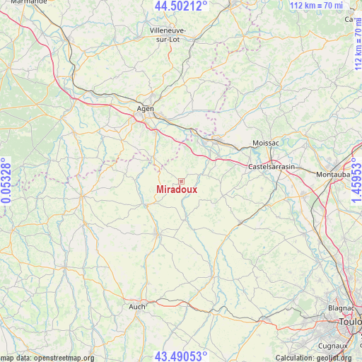
Miradoux GPS coordinates[2]
43° 59' 54.528" North, 0° 45' 23.076" East
| Map corner | latitude | longitude |
|---|---|---|
| Upper-left | 44.50212°, | 0.05328° |
| Center: | 43.99848°, | 0.75641° |
| Lower-right: | 43.49053°, | 1.45953° |
| Map W x H: | 112.5×112.5 km | = 69.9×69.9mi |
| max Lat: | 51.07786° ⇑87.1% North |
| Miradoux: | 43.99848° |
| min Lat: | ⇓12.9% South 41.3874° |
| min Long | Miradoux | max Long |
| -5.08615° | 0.75641° | 9.52242° |
| W 29.1%⇐ | ⇒70.9% E |
Elevation
Elevation of Miradoux is 209 m = 686 ft, and this is 15.3 m = 50 ft above average elevation for this country.
| Max E: |
2333 m = 7654 ft | 32% |
| Miradoux | 209 m 686 ft | |
| Avg. | 193.7 m = 635 ft | |
Min E: |
-1 m = -3 ft | 68% |
See also: France elevation on elevation.city.
Geographical zone
Miradoux is located in North temperate zone (between Tropic of Cancer and the Arctic Circle). Distance of this Northern Tropic circle is 2286.3 km =1420.6 mi to South.| Distance of | km | miles | from Miradoux |
|---|---|---|---|
| North Pole | 5114.9 | 3178.3 | to North |
| Arctic Circle | 2509 | 1559 | to North |
| Tropic Cancer | 2286.3 | 1420.6 | to South |
| Equator | 4892.2 | 3039.9 | to South |


Nearby cities:
15 places around Miradoux: (largest is in red/bold)
• Astaffort
11.1 km =6.9 mi,  311°
311°
• Auvillar
14 km =8.7 mi,  56°
56°
• Caudecoste
13.2 km =8.2 mi,  353°
353°
• Donzac
13.4 km =8.3 mi,  22°
22°
• Dunes
10.1 km =6.3 mi,  6°
6°
• Fleurance
18.3 km =11.4 mi,  204°
204°
• Golfech
15 km =9.3 mi,  30°
30°
• Goudourville
18.9 km =11.7 mi,  46°
46°
• Lamagistère
15.1 km =9.4 mi, 21°
• Lavit
13.9 km =8.6 mi,  109°
109°
• Layrac
16.9 km =10.5 mi,  333°
333°
• Lectoure
12.9 km =8 mi,  236°
236°
• Pauilhac
17.8 km =11.1 mi,  220°
220°
• Saint-Clar
12.1 km =7.5 mi,  174°
174°
• Valence
16.3 km =10.1 mi,  41°
41°
Sources, notices
• [Note1] Compared only with cities in France existing in our database
• [Src1] Map data: © OpenStreetMap contributors (CC-BY-SA)
• [Src2] Other city data from geonames.org with taken over terms of usage.
• [Src3] Geographical zone / Annual Mean Temperature by Robert A. Rohde @ Wikipedia
