Bourgtheroulde-Infreville geodata
Bourgtheroulde-Infreville (Normandy) is a populated place; located in France in Europe/Paris (GMT+2) time zone. With population of 2,969 people, there are 3285 cities with bigger population in this country. Compared to other cities in France, 86.1% of cities are located further ↓South; 69.9% of cities are located further →East and 53.1% of cities have higher elevation than Bourgtheroulde-Infreville. Note1
Administrative division(s):
- Level 1: Normandy
- Level 2: Département de l'Eure
- Level 3: Arrondissement de Bernay
- Level 4: Grand Bourgtheroulde
Current local time in Bourgtheroulde-Infreville:
06:02 AM, WednesdayDifference from your time zone: hours


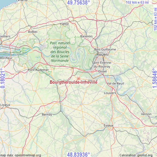
Bourgtheroulde-Infreville GPS coordinates[2]
49° 18' 0" North, 0° 52' 59.988" East
| Map corner | latitude | longitude |
|---|---|---|
| Upper-left | 49.75638°, | 0.18021° |
| Center: | 49.3°, | 0.88333° |
| Lower-right: | 48.83936°, | 1.58646° |
| Map W x H: | 102×102 km | = 63.4×63.4mi |
| max Lat: | 51.07786° ⇑13.9% North |
| Bourgtheroulde-Infreville: | 49.3° |
| min Lat: | ⇓86.1% South 41.3874° |
| min Long | Bourgtheroulde- | max Long |
| -5.08615° | 0.88333° | 9.52242° |
| W 30.1%⇐ | ⇒69.9% E |
Elevation
Elevation of Bourgtheroulde-Infreville is 122 m = 400 ft, and this is 71.7 m = 235 ft below average elevation for this country.
| Max E: |
2333 m = 7654 ft | 53.1% |
| Avg. | 193.7 m = 635 ft | |
| Bourgtheroulde-Infreville | 122 m = 400 ft | |
Min E: |
-1 m = -3 ft | 46.9% |
See also: France elevation on elevation.city.
Geographical zone
Bourgtheroulde-Infreville is located in North temperate zone (between Tropic of Cancer and the Arctic Circle). Distance of this North polar circle is 1919.5 km =1192.7 mi to North.| Distance of | km | miles | from Bourgtheroulde-Infreville |
|---|---|---|---|
| North Pole | 4525.4 | 2812 | to North |
| Arctic Circle | 1919.5 | 1192.7 | to North |
| Tropic Cancer | 2875.7 | 1786.9 | to South |
| Equator | 5481.6 | 3406.1 | to South |


Nearby cities:
15 places around Bourgtheroulde-Infreville: (largest is in red/bold)
• Berville-en-Roumois
4.4 km =2.7 mi,  264°
264°
• Boissey-le-Châtel
7.9 km =4.9 mi,  245°
245°
• Bosgouet
6.3 km =3.9 mi,  341°
341°
• Bosguérard-de-Marcouville
4.8 km =3 mi,  226°
226°
• Bourg-Achard
7.7 km =4.8 mi,  320°
320°
• Caumont
7.4 km =4.6 mi,  7°
7°
• La Bouille
6.6 km =4.1 mi,  33°
33°
• Le Bosc-Roger-en-Roumois
4.1 km =2.5 mi,  117°
117°
• Le Thuit-Anger
6.9 km =4.3 mi,  114°
114°
• Le Thuit-Signol
5.6 km =3.5 mi,  133°
133°
• Moulineaux
7.3 km =4.5 mi,  48°
48°
• Sahurs
7.8 km =4.8 mi, 33°
• Saint-Ouen-de-Thouberville
6.4 km =4 mi,  3°
3°
• Saint-Ouen-du-Tilleul
4.7 km =2.9 mi,  93°
93°
• Saint-Pierre-du-Bosguérard
4.1 km =2.5 mi,  180°
180°
Sources, notices
• [Note1] Compared only with cities in France existing in our database
• [Src1] Map data: © OpenStreetMap contributors (CC-BY-SA)
• [Src2] Other city data from geonames.org with taken over terms of usage.
• [Src3] Geographical zone / Annual Mean Temperature by Robert A. Rohde @ Wikipedia
