Sahurs geodata
Sahurs (Normandy) is a populated place; located in France in Europe/Paris (GMT+2) time zone. With population of 1,142 people, there are 7876 cities with bigger population in this country. Compared to other cities in France, 87.2% of cities are located further ↓South; 69.3% of cities are located further →East and 97.8% of cities have higher elevation than Sahurs. Note1
Administrative division(s):
- Level 1: Normandy
- Level 2: Seine-Maritime
- Level 3: Arrondissement de Rouen
- Level 4: Sahurs


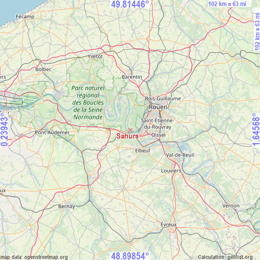
Sahurs GPS coordinates[2]
49° 21' 31.068" North, 0° 56' 33.216" East
| Map corner | latitude | longitude |
|---|---|---|
| Upper-left | 49.81446°, | 0.23943° |
| Center: | 49.35863°, | 0.94256° |
| Lower-right: | 48.89854°, | 1.64568° |
| Map W x H: | 101.8×101.8 km | = 63.3×63.3mi |
| max Lat: | 51.07786° ⇑12.8% North |
| Sahurs: | 49.35863° |
| min Lat: | ⇓87.2% South 41.3874° |
| min Long | Sahurs | max Long |
| -5.08615° | 0.94256° | 9.52242° |
| W 30.7%⇐ | ⇒69.3% E |
Elevation
Elevation of Sahurs is 9 m = 30 ft, and this is 184.7 m = 606 ft below average elevation for this country.
| Max E: |
2333 m = 7654 ft | 97.8% |
| Avg. | 193.7 m = 635 ft | |
| Sahurs | 9 m = 30 ft | |
Min E: |
-1 m = -3 ft | 2.2% |
See also: France elevation on elevation.city.
Geographical zone
Sahurs is located in North temperate zone (between Tropic of Cancer and the Arctic Circle). Distance of this North polar circle is 1913 km =1188.7 mi to North.| Distance of | km | miles | from Sahurs |
|---|---|---|---|
| North Pole | 4518.9 | 2807.9 | to North |
| Arctic Circle | 1913 | 1188.7 | to North |
| Tropic Cancer | 2882.2 | 1790.9 | to South |
| Equator | 5488.2 | 3410.2 | to South |


Nearby cities:
15 places around Sahurs: (largest is in red/bold)
• Bosgouet
6.3 km =3.9 mi,  265°
265°
• Bourgtheroulde-Infreville
7.8 km =4.8 mi,  213°
213°
• Caumont
3.5 km =2.2 mi,  284°
284°
• Cléon
8.1 km =5 mi,  129°
129°
• Grand-Couronne
4.6 km =2.9 mi,  94°
94°
• La Bouille
1.2 km =0.7 mi, 214°
• Le Bosc-Roger-en-Roumois
8.4 km =5.2 mi,  184°
184°
• Moulineaux
2.1 km =1.3 mi,  145°
145°
• Petit-Couronne
6 km =3.7 mi,  62°
62°
• Quevillon
6.8 km =4.2 mi,  6°
6°
• Saint-Aubin-lès-Elbeuf
7.9 km =4.9 mi,  141°
141°
• Saint-Ouen-de-Thouberville
3.9 km =2.4 mi, 267°
• Saint-Ouen-du-Tilleul
6.8 km =4.2 mi, 176°
• Saint-Pierre-de-Manneville
3.9 km =2.4 mi,  350°
350°
• Val-de-la-Haye
4.8 km =3 mi, 62°
Sources, notices
• [Note1] Compared only with cities in France existing in our database
• [Src1] Map data: © OpenStreetMap contributors (CC-BY-SA)
• [Src2] Other city data from geonames.org with taken over terms of usage.
• [Src3] Geographical zone / Annual Mean Temperature by Robert A. Rohde @ Wikipedia
