Bouillé-Ménard geodata
Bouillé-Ménard (Pays de la Loire) is a populated place; located in France in Europe/Paris (GMT+2) time zone. With population of 683 people, there are 12036 cities with bigger population in this country. Compared to other cities in France, 54.9% of cities are located further ↓South; 87.9% of cities are located further →East and 82.2% of cities have higher elevation than Bouillé-Ménard. Note1
Administrative division(s):
- Level 1: Pays de la Loire
- Level 2: Département de Maine-et-Loire
- Level 3: Arrondissement de Segré
- Level 4: Bouillé-Ménard


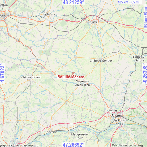
Bouillé-Ménard GPS coordinates[2]
47° 44' 30.84" North, 0° 58' 1.596" West
| Map corner | latitude | longitude |
|---|---|---|
| Upper-left | 48.21259°, | -1.67023° |
| Center: | 47.7419°, | -0.96711° |
| Lower-right: | 47.26692°, | -0.26398° |
| Map W x H: | 105.1×105.1 km | = 65.3×65.3mi |
| max Lat: | 51.07786° ⇑45.1% North |
| Bouillé-Ménard: | 47.7419° |
| min Lat: | ⇓54.9% South 41.3874° |
| min Long | Bouillé-Ménar | max Long |
| -5.08615° | -0.96711° | 9.52242° |
| W 12.1%⇐ | ⇒87.9% E |
Elevation
Elevation of Bouillé-Ménard is 49 m = 161 ft, and this is 144.7 m = 475 ft below average elevation for this country.
| Max E: |
2333 m = 7654 ft | 82.2% |
| Avg. | 193.7 m = 635 ft | |
| Bouillé-Ménard | 49 m = 161 ft | |
Min E: |
-1 m = -3 ft | 17.8% |
See also: France elevation on elevation.city.
Geographical zone
Bouillé-Ménard is located in North temperate zone (between Tropic of Cancer and the Arctic Circle). Distance of this North polar circle is 2092.8 km =1300.4 mi to North.| Distance of | km | miles | from Bouillé-Ménard |
|---|---|---|---|
| North Pole | 4698.7 | 2919.6 | to North |
| Arctic Circle | 2092.8 | 1300.4 | to North |
| Tropic Cancer | 2702.5 | 1679.3 | to South |
| Equator | 5308.4 | 3298.5 | to South |


Nearby cities:
15 places around Bouillé-Ménard: (largest is in red/bold)
• Bouchamps-lès-Craon
8.4 km =5.2 mi,  347°
347°
• Challain-la-Potherie
13.2 km =8.2 mi,  207°
207°
• Chazé-Henry
10.9 km =6.8 mi,  276°
276°
• Châtelais
3.5 km =2.2 mi,  58°
58°
• Combrée
6.3 km =3.9 mi,  228°
228°
• Congrier
13.5 km =8.4 mi,  304°
304°
• Craon
11.7 km =7.3 mi,  6°
6°
• La Chapelle-sur-Oudon
12.7 km =7.9 mi,  124°
124°
• La Selle-Craonnaise
12.6 km =7.8 mi,  333°
333°
• Noyant-la-Gravoyère
4.3 km =2.7 mi,  170°
170°
• Nyoiseau
4.7 km =2.9 mi,  126°
126°
• Pommerieux
10.4 km =6.5 mi,  29°
29°
• Renazé
8.7 km =5.4 mi,  311°
311°
• Saint-Saturnin-du-Limet
10.8 km =6.7 mi,  316°
316°
• Segré
9.4 km =5.8 mi, 131°
Sources, notices
• [Note1] Compared only with cities in France existing in our database
• [Src1] Map data: © OpenStreetMap contributors (CC-BY-SA)
• [Src2] Other city data from geonames.org with taken over terms of usage.
• [Src3] Geographical zone / Annual Mean Temperature by Robert A. Rohde @ Wikipedia
