Bou geodata
Bou (Centre) is a populated place; located in France in Europe/Paris (GMT+2) time zone. With population of 922 people, there are 9460 cities with bigger population in this country. Compared to other cities in France, 57.1% of cities are located further ↓South; 56.5% of cities are located further →East and 61.5% of cities have higher elevation than Bou. Note1
Administrative division(s):
- Level 1: Centre
- Level 2: Loiret
- Level 3: Arrondissement d’Orléans
- Level 4: Bou


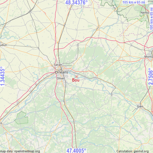
Bou GPS coordinates[2]
47° 52' 27.408" North, 2° 2' 50.892" East
| Map corner | latitude | longitude |
|---|---|---|
| Upper-left | 48.34376°, | 1.34435° |
| Center: | 47.87428°, | 2.04747° |
| Lower-right: | 47.4005°, | 2.7506° |
| Map W x H: | 104.9×104.9 km | = 65.2×65.2mi |
| max Lat: | 51.07786° ⇑42.9% North |
| Bou: | 47.87428° |
| min Lat: | ⇓57.1% South 41.3874° |
| min Long | Bou | max Long |
| -5.08615° | 2.04747° | 9.52242° |
| W 43.5%⇐ | ⇒56.5% E |
Elevation
Elevation of Bou is 98 m = 322 ft, and this is 95.7 m = 314 ft below average elevation for this country.
| Max E: |
2333 m = 7654 ft | 61.5% |
| Avg. | 193.7 m = 635 ft | |
| Bou | 98 m = 322 ft | |
Min E: |
-1 m = -3 ft | 38.5% |
See also: France elevation on elevation.city.
Geographical zone
Bou is located in North temperate zone (between Tropic of Cancer and the Arctic Circle). Distance of this North polar circle is 2078.1 km =1291.3 mi to North.| Distance of | km | miles | from Bou |
|---|---|---|---|
| North Pole | 4683.9 | 2910.4 | to North |
| Arctic Circle | 2078.1 | 1291.3 | to North |
| Tropic Cancer | 2717.2 | 1688.4 | to South |
| Equator | 5323.1 | 3307.6 | to South |


Nearby cities:
15 places around Bou: (largest is in red/bold)
• Boigny-sur-Bionne
7 km =4.3 mi,  340°
340°
• Chécy
2.9 km =1.8 mi,  320°
320°
• Darvoy
4.3 km =2.7 mi,  114°
114°
• Donnery
6.1 km =3.8 mi,  42°
42°
• Fay-aux-Loges
9.1 km =5.7 mi,  49°
49°
• Férolles
6.5 km =4 mi,  132°
132°
• Jargeau
6 km =3.7 mi,  101°
101°
• Mardié
1.5 km =0.9 mi,  29°
29°
• Marigny-les-Usages
9.6 km =6 mi,  345°
345°
• Saint-Cyr-en-Val
7.7 km =4.8 mi,  231°
231°
• Saint-Denis-en-Val
6.1 km =3.8 mi,  268°
268°
• Saint-Jean-de-Braye
6.8 km =4.2 mi,  309°
309°
• Sandillon
3.5 km =2.2 mi,  200°
200°
• Semoy
9.8 km =6.1 mi, 312°
• Vennecy
9 km =5.6 mi,  3°
3°
Sources, notices
• [Note1] Compared only with cities in France existing in our database
• [Src1] Map data: © OpenStreetMap contributors (CC-BY-SA)
• [Src2] Other city data from geonames.org with taken over terms of usage.
• [Src3] Geographical zone / Annual Mean Temperature by Robert A. Rohde @ Wikipedia
