Darvoy geodata
Darvoy (Centre) is a populated place; located in France in Europe/Paris (GMT+2) time zone. With population of 1,825 people, there are 5200 cities with bigger population in this country. Compared to other cities in France, 56.7% of cities are located further ↓South; 55.8% of cities are located further →East and 60% of cities have higher elevation than Darvoy. Note1
Administrative division(s):
- Level 1: Centre
- Level 2: Loiret
- Level 3: Arrondissement d’Orléans
- Level 4: Darvoy


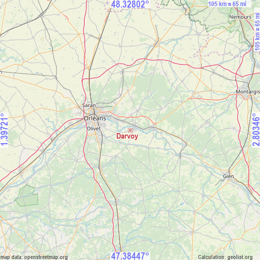
Darvoy GPS coordinates[2]
47° 51' 30.204" North, 2° 6' 1.188" East
| Map corner | latitude | longitude |
|---|---|---|
| Upper-left | 48.32802°, | 1.39721° |
| Center: | 47.85839°, | 2.10033° |
| Lower-right: | 47.38447°, | 2.80346° |
| Map W x H: | 104.9×104.9 km | = 65.2×65.2mi |
| max Lat: | 51.07786° ⇑43.3% North |
| Darvoy: | 47.85839° |
| min Lat: | ⇓56.7% South 41.3874° |
| min Long | Darvoy | max Long |
| -5.08615° | 2.10033° | 9.52242° |
| W 44.2%⇐ | ⇒55.8% E |
Elevation
Elevation of Darvoy is 102 m = 335 ft, and this is 91.7 m = 301 ft below average elevation for this country.
| Max E: |
2333 m = 7654 ft | 60% |
| Avg. | 193.7 m = 635 ft | |
| Darvoy | 102 m = 335 ft | |
Min E: |
-1 m = -3 ft | 40% |
See also: France elevation on elevation.city.
Geographical zone
Darvoy is located in North temperate zone (between Tropic of Cancer and the Arctic Circle). Distance of this North polar circle is 2079.8 km =1292.3 mi to North.| Distance of | km | miles | from Darvoy |
|---|---|---|---|
| North Pole | 4685.7 | 2911.6 | to North |
| Arctic Circle | 2079.8 | 1292.3 | to North |
| Tropic Cancer | 2715.4 | 1687.3 | to South |
| Equator | 5321.4 | 3306.6 | to South |


Nearby cities:
15 places around Darvoy: (largest is in red/bold)
• Boigny-sur-Bionne
10.4 km =6.5 mi,  323°
323°
• Bou
4.3 km =2.7 mi,  294°
294°
• Châteauneuf-sur-Loire
8.9 km =5.5 mi,  84°
84°
• Chécy
7 km =4.3 mi,  304°
304°
• Donnery
6.3 km =3.9 mi,  1°
1°
• Fay-aux-Loges
8.2 km =5.1 mi,  21°
21°
• Férolles
2.7 km =1.7 mi,  162°
162°
• Jargeau
2 km =1.2 mi,  74°
74°
• Mardié
4.4 km =2.7 mi,  314°
314°
• Saint-Cyr-en-Val
10.4 km =6.5 mi,  253°
253°
• Saint-Denis-en-Val
10.2 km =6.3 mi,  279°
279°
• Sandillon
5.3 km =3.3 mi, 253°
• Sigloy
9.8 km =6.1 mi,  106°
106°
• Tigy
10.2 km =6.3 mi,  134°
134°
• Vienne-en-Val
6.9 km =4.3 mi, 158°
Sources, notices
• [Note1] Compared only with cities in France existing in our database
• [Src1] Map data: © OpenStreetMap contributors (CC-BY-SA)
• [Src2] Other city data from geonames.org with taken over terms of usage.
• [Src3] Geographical zone / Annual Mean Temperature by Robert A. Rohde @ Wikipedia
