Boisgervilly geodata
Boisgervilly (Brittany) is a populated place; located in France in Europe/Paris (GMT+2) time zone. With population of 1,350 people, there are 6810 cities with bigger population in this country. Compared to other cities in France, 62.2% of cities are located further ↓South; 95.1% of cities are located further →East and 63.2% of cities have higher elevation than Boisgervilly. Note1
Administrative division(s):
- Level 1: Brittany
- Level 2: Département d'Ille-et-Vilaine
- Level 3: Arrondissement de Rennes
- Level 4: Boisgervilly


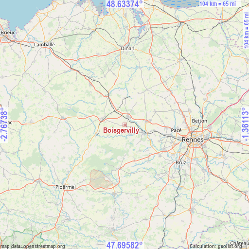
Boisgervilly GPS coordinates[2]
48° 10' 0.912" North, 2° 3' 51.336" West
| Map corner | latitude | longitude |
|---|---|---|
| Upper-left | 48.63374°, | -2.76738° |
| Center: | 48.16692°, | -2.06426° |
| Lower-right: | 47.69582°, | -1.36113° |
| Map W x H: | 104.3×104.3 km | = 64.8×64.8mi |
| max Lat: | 51.07786° ⇑37.8% North |
| Boisgervilly: | 48.16692° |
| min Lat: | ⇓62.2% South 41.3874° |
| min Long | Boisgervilly | max Long |
| -5.08615° | -2.06426° | 9.52242° |
| W 4.9%⇐ | ⇒95.1% E |
Elevation
Elevation of Boisgervilly is 94 m = 308 ft, and this is 99.7 m = 327 ft below average elevation for this country.
| Max E: |
2333 m = 7654 ft | 63.2% |
| Avg. | 193.7 m = 635 ft | |
| Boisgervilly | 94 m = 308 ft | |
Min E: |
-1 m = -3 ft | 36.8% |
See also: France elevation on elevation.city.
Geographical zone
Boisgervilly is located in North temperate zone (between Tropic of Cancer and the Arctic Circle). Distance of this North polar circle is 2045.5 km =1271 mi to North.| Distance of | km | miles | from Boisgervilly |
|---|---|---|---|
| North Pole | 4651.4 | 2890.2 | to North |
| Arctic Circle | 2045.5 | 1271 | to North |
| Tropic Cancer | 2749.7 | 1708.6 | to South |
| Equator | 5355.7 | 3327.9 | to South |


Nearby cities:
15 places around Boisgervilly: (largest is in red/bold)
• Breteil
12.5 km =7.8 mi,  101°
101°
• Bédée
9 km =5.6 mi,  81°
81°
• Gaël
12.4 km =7.7 mi,  251°
251°
• Iffendic
4.7 km =2.9 mi,  152°
152°
• Irodouër
12.5 km =7.8 mi,  42°
42°
• Landujan
10.6 km =6.6 mi,  28°
28°
• Montauban-de-Bretagne
3.9 km =2.4 mi,  21°
21°
• Montfort-sur-Meu
9 km =5.6 mi,  112°
112°
• Muel
8.3 km =5.2 mi,  237°
237°
• Médréac
11.1 km =6.9 mi,  359°
359°
• Pleumeleuc
10.9 km =6.8 mi, 79°
• Quédillac
10.8 km =6.7 mi,  327°
327°
• Saint-Méen-le-Grand
10 km =6.2 mi,  284°
284°
• Saint-Onen-la-Chapelle
8.2 km =5.1 mi, 277°
• Talensac
12 km =7.5 mi,  122°
122°
Sources, notices
• [Note1] Compared only with cities in France existing in our database
• [Src1] Map data: © OpenStreetMap contributors (CC-BY-SA)
• [Src2] Other city data from geonames.org with taken over terms of usage.
• [Src3] Geographical zone / Annual Mean Temperature by Robert A. Rohde @ Wikipedia
