Landujan geodata
Landujan (Brittany) is a populated place; located in France in Europe/Paris (GMT+2) time zone. With population of 745 people, there are 11223 cities with bigger population in this country. Compared to other cities in France, 63.7% of cities are located further ↓South; 94.8% of cities are located further →East and 61.5% of cities have higher elevation than Landujan. Note1
Administrative division(s):
- Level 1: Brittany
- Level 2: Département d'Ille-et-Vilaine
- Level 3: Arrondissement de Rennes
- Level 4: Landujan


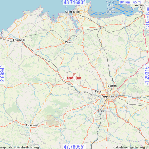
Landujan GPS coordinates[2]
48° 15' 3.168" North, 1° 59' 46.572" West
| Map corner | latitude | longitude |
|---|---|---|
| Upper-left | 48.71693°, | -2.6994° |
| Center: | 48.25088°, | -1.99627° |
| Lower-right: | 47.78055°, | -1.29315° |
| Map W x H: | 104.1×104.1 km | = 64.7×64.7mi |
| max Lat: | 51.07786° ⇑36.3% North |
| Landujan: | 48.25088° |
| min Lat: | ⇓63.7% South 41.3874° |
| min Long | Landujan | max Long |
| -5.08615° | -1.99627° | 9.52242° |
| W 5.2%⇐ | ⇒94.8% E |
Elevation
Elevation of Landujan is 98 m = 322 ft, and this is 95.7 m = 314 ft below average elevation for this country.
| Max E: |
2333 m = 7654 ft | 61.5% |
| Avg. | 193.7 m = 635 ft | |
| Landujan | 98 m = 322 ft | |
Min E: |
-1 m = -3 ft | 38.5% |
See also: France elevation on elevation.city.
Geographical zone
Landujan is located in North temperate zone (between Tropic of Cancer and the Arctic Circle). Distance of this North polar circle is 2036.2 km =1265.2 mi to North.| Distance of | km | miles | from Landujan |
|---|---|---|---|
| North Pole | 4642.1 | 2884.5 | to North |
| Arctic Circle | 2036.2 | 1265.2 | to North |
| Tropic Cancer | 2759.1 | 1714.4 | to South |
| Equator | 5365 | 3333.7 | to South |


Nearby cities:
15 places around Landujan: (largest is in red/bold)
• Boisgervilly
10.6 km =6.6 mi,  208°
208°
• Bécherel
6.3 km =3.9 mi,  37°
37°
• Bédée
8.8 km =5.5 mi,  154°
154°
• Guitté
8.9 km =5.5 mi,  304°
304°
• Irodouër
3.5 km =2.2 mi,  92°
92°
• La Baussaine
10 km =6.2 mi,  46°
46°
• La Chapelle-Chaussée
10.7 km =6.6 mi,  77°
77°
• Miniac-sous-Bécherel
6.1 km =3.8 mi, 52°
• Montauban-de-Bretagne
6.8 km =4.2 mi, 212°
• Médréac
5.5 km =3.4 mi,  289°
289°
• Pleumeleuc
9.3 km =5.8 mi,  142°
142°
• Plouasne
5.6 km =3.5 mi,  351°
351°
• Romillé
8.6 km =5.3 mi,  116°
116°
• Saint-Pern
4.1 km =2.5 mi,  9°
9°
• Saint-Thual
10.6 km =6.6 mi,  25°
25°
Sources, notices
• [Note1] Compared only with cities in France existing in our database
• [Src1] Map data: © OpenStreetMap contributors (CC-BY-SA)
• [Src2] Other city data from geonames.org with taken over terms of usage.
• [Src3] Geographical zone / Annual Mean Temperature by Robert A. Rohde @ Wikipedia
