Boisemont geodata
Boisemont (Normandy) is a populated place; located in France in Europe/Paris (GMT+2) time zone. With population of 710 people, there are 11647 cities with bigger population in this country. Compared to other cities in France, 85.8% of cities are located further ↓South; 63% of cities are located further →East and 56.1% of cities have lower elevation than Boisemont. Note1
Administrative division(s):
- Level 1: Normandy
- Level 2: Département de l'Eure
- Level 3: Les Andelys
- Level 4: Frenelles-en-Vexin


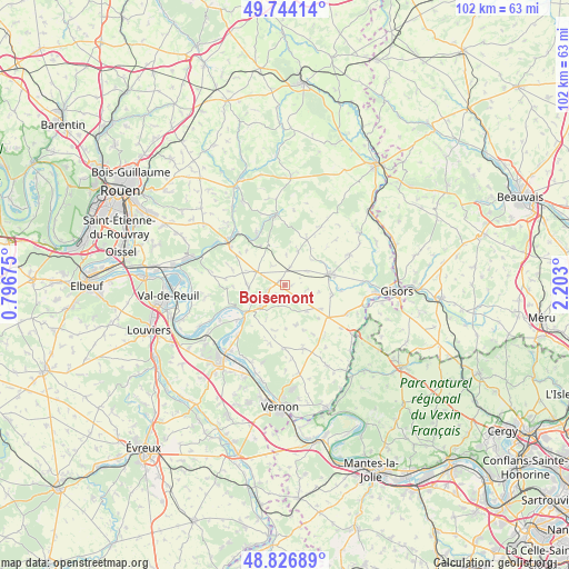
Boisemont GPS coordinates[2]
49° 17' 15.54" North, 1° 29' 59.568" East
| Map corner | latitude | longitude |
|---|---|---|
| Upper-left | 49.74414°, | 0.79675° |
| Center: | 49.28765°, | 1.49988° |
| Lower-right: | 48.82689°, | 2.203° |
| Map W x H: | 102×102 km | = 63.4×63.4mi |
| max Lat: | 51.07786° ⇑14.2% North |
| Boisemont: | 49.28765° |
| min Lat: | ⇓85.8% South 41.3874° |
| min Long | Boisemont | max Long |
| -5.08615° | 1.49988° | 9.52242° |
| W 37%⇐ | ⇒63% E |
Elevation
Elevation of Boisemont is 154 m = 505 ft, and this is 39.7 m = 130 ft below average elevation for this country.
| Max E: |
2333 m = 7654 ft | 43.9% |
| Avg. | 193.7 m = 635 ft | |
| Boisemont | 154 m = 505 ft | |
Min E: |
-1 m = -3 ft | 56.1% |
See also: France elevation on elevation.city.
Geographical zone
Boisemont is located in North temperate zone (between Tropic of Cancer and the Arctic Circle). Distance of this North polar circle is 1920.9 km =1193.6 mi to North.| Distance of | km | miles | from Boisemont |
|---|---|---|---|
| North Pole | 4526.8 | 2812.8 | to North |
| Arctic Circle | 1920.9 | 1193.6 | to North |
| Tropic Cancer | 2874.4 | 1786.1 | to South |
| Equator | 5480.3 | 3405.3 | to South |


Nearby cities:
15 places around Boisemont: (largest is in red/bold)
• Bouafles
11.6 km =7.2 mi,  224°
224°
• Charleval
12.7 km =7.9 mi,  318°
318°
• Grainville
11.7 km =7.3 mi,  304°
304°
• Hennezis
10.8 km =6.7 mi,  193°
193°
• Heudicourt
12.8 km =8 mi,  64°
64°
• Les Andelys
7.9 km =4.9 mi,  233°
233°
• Les Thilliers-en-Vexin
9.5 km =5.9 mi,  126°
126°
• Longchamps
12.2 km =7.6 mi,  48°
48°
• Lyons-la-Forêt
12.5 km =7.8 mi,  352°
352°
• Mézières-en-Vexin
12.8 km =8 mi,  178°
178°
• Tosny
11.9 km =7.4 mi, 230°
• Tourny
12.1 km =7.5 mi,  164°
164°
• Vesly
12.1 km =7.5 mi,  114°
114°
• Écouis
5.6 km =3.5 mi, 297°
• Étrépagny
8.3 km =5.2 mi,  75°
75°
Sources, notices
• [Note1] Compared only with cities in France existing in our database
• [Src1] Map data: © OpenStreetMap contributors (CC-BY-SA)
• [Src2] Other city data from geonames.org with taken over terms of usage.
• [Src3] Geographical zone / Annual Mean Temperature by Robert A. Rohde @ Wikipedia
