Lyons-la-Forêt geodata
Lyons-la-Forêt (Normandy) is a populated place; located in France in Europe/Paris (GMT+2) time zone. With population of 836 people, there are 10228 cities with bigger population in this country. Compared to other cities in France, 87.9% of cities are located further ↓South; 63.3% of cities are located further →East and 58.7% of cities have higher elevation than Lyons-la-Forêt. Note1
Administrative division(s):
- Level 1: Normandy
- Level 2: Département de l'Eure
- Level 3: Les Andelys
- Level 4: Lyons-la-Forêt


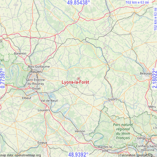
Lyons-la-Forêt GPS coordinates[2]
49° 23' 56.112" North, 1° 28' 37.524" East
| Map corner | latitude | longitude |
|---|---|---|
| Upper-left | 49.85438°, | 0.77397° |
| Center: | 49.39892°, | 1.47709° |
| Lower-right: | 48.9392°, | 2.18022° |
| Map W x H: | 101.8×101.8 km | = 63.3×63.3mi |
| max Lat: | 51.07786° ⇑12.1% North |
| Lyons-la-Forêt: | 49.39892° |
| min Lat: | ⇓87.9% South 41.3874° |
| min Long | Lyons-la-Forêt | max Long |
| -5.08615° | 1.47709° | 9.52242° |
| W 36.7%⇐ | ⇒63.3% E |
Elevation
Elevation of Lyons-la-Forêt is 106 m = 348 ft, and this is 87.7 m = 288 ft below average elevation for this country.
| Max E: |
2333 m = 7654 ft | 58.7% |
| Avg. | 193.7 m = 635 ft | |
| Lyons-la-Forêt | 106 m = 348 ft | |
Min E: |
-1 m = -3 ft | 41.3% |
See also: France elevation on elevation.city.
Geographical zone
Lyons-la-Forêt is located in North temperate zone (between Tropic of Cancer and the Arctic Circle). Distance of this North polar circle is 1908.5 km =1185.9 mi to North.| Distance of | km | miles | from Lyons-la-Forêt |
|---|---|---|---|
| North Pole | 4514.4 | 2805.1 | to North |
| Arctic Circle | 1908.5 | 1185.9 | to North |
| Tropic Cancer | 2886.7 | 1793.7 | to South |
| Equator | 5492.6 | 3412.9 | to South |


Nearby cities:
15 places around Lyons-la-Forêt: (largest is in red/bold)
• Boisemont
12.5 km =7.8 mi,  172°
172°
• Bourg-Beaudouin
12.2 km =7.6 mi,  263°
263°
• Charleval
7.4 km =4.6 mi,  246°
246°
• Fleury-sur-Andelle
9.7 km =6 mi,  244°
244°
• Grainville
9.8 km =6.1 mi,  234°
234°
• La Feuillie
7.7 km =4.8 mi,  20°
20°
• Les Hogues
6.5 km =4 mi,  297°
297°
• Longchamps
11.5 km =7.1 mi,  111°
111°
• Perriers-sur-Andelle
7.9 km =4.9 mi,  283°
283°
• Radepont
12 km =7.5 mi, 243°
• Ry
12.6 km =7.8 mi,  309°
309°
• Saint-Denis-le-Thiboult
10.6 km =6.6 mi, 309°
• Saint-Lucien
12.4 km =7.7 mi,  350°
350°
• Vandrimare
9.9 km =6.2 mi, 257°
• Écouis
10.3 km =6.4 mi,  198°
198°
Sources, notices
• [Note1] Compared only with cities in France existing in our database
• [Src1] Map data: © OpenStreetMap contributors (CC-BY-SA)
• [Src2] Other city data from geonames.org with taken over terms of usage.
• [Src3] Geographical zone / Annual Mean Temperature by Robert A. Rohde @ Wikipedia
