Longchamps geodata
Longchamps (Normandy) is a populated place; located in France in Europe/Paris (GMT+2) time zone. With population of 526 people, there are 14691 cities with bigger population in this country. Compared to other cities in France, 87.2% of cities are located further ↓South; 61.3% of cities are located further →East and 54.8% of cities have higher elevation than Longchamps. Note1
Administrative division(s):
- Level 1: Normandy
- Level 2: Département de l'Eure
- Level 3: Les Andelys
- Level 4: Longchamps


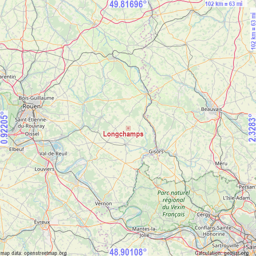
Longchamps GPS coordinates[2]
49° 21' 40.14" North, 1° 37' 30.612" East
| Map corner | latitude | longitude |
|---|---|---|
| Upper-left | 49.81696°, | 0.92205° |
| Center: | 49.36115°, | 1.62517° |
| Lower-right: | 48.90108°, | 2.3283° |
| Map W x H: | 101.8×101.8 km | = 63.3×63.3mi |
| max Lat: | 51.07786° ⇑12.8% North |
| Longchamps: | 49.36115° |
| min Lat: | ⇓87.2% South 41.3874° |
| min Long | Longchamps | max Long |
| -5.08615° | 1.62517° | 9.52242° |
| W 38.7%⇐ | ⇒61.3% E |
Elevation
Elevation of Longchamps is 117 m = 384 ft, and this is 76.7 m = 252 ft below average elevation for this country.
| Max E: |
2333 m = 7654 ft | 54.8% |
| Avg. | 193.7 m = 635 ft | |
| Longchamps | 117 m = 384 ft | |
Min E: |
-1 m = -3 ft | 45.2% |
See also: France elevation on elevation.city.
Geographical zone
Longchamps is located in North temperate zone (between Tropic of Cancer and the Arctic Circle). Distance of this North polar circle is 1912.7 km =1188.5 mi to North.| Distance of | km | miles | from Longchamps |
|---|---|---|---|
| North Pole | 4518.6 | 2807.7 | to North |
| Arctic Circle | 1912.7 | 1188.5 | to North |
| Tropic Cancer | 2882.5 | 1791.1 | to South |
| Equator | 5488.4 | 3410.3 | to South |


Nearby cities:
15 places around Longchamps: (largest is in red/bold)
• Bazincourt-sur-Epte
11.5 km =7.1 mi,  117°
117°
• Boisemont
12.2 km =7.6 mi,  228°
228°
• Bézu-Saint-Éloi
9.3 km =5.8 mi,  142°
142°
• Dangu
13 km =8.1 mi,  157°
157°
• Heudicourt
3.6 km =2.2 mi, 137°
• Hébécourt
7.4 km =4.6 mi,  96°
96°
• Lalande-en-Son
11.9 km =7.4 mi,  73°
73°
• Les Thilliers-en-Vexin
13.9 km =8.6 mi,  185°
185°
• Lyons-la-Forêt
11.5 km =7.1 mi,  291°
291°
• Neaufles-Saint-Martin
12 km =7.5 mi, 141°
• Sérifontaine
10.4 km =6.5 mi,  94°
94°
• Talmontiers
8.9 km =5.5 mi, 72°
• Vesly
13.3 km =8.3 mi,  171°
171°
• Éragny-sur-Epte
12 km =7.5 mi, 115°
• Étrépagny
6.2 km =3.9 mi, 189°
Sources, notices
• [Note1] Compared only with cities in France existing in our database
• [Src1] Map data: © OpenStreetMap contributors (CC-BY-SA)
• [Src2] Other city data from geonames.org with taken over terms of usage.
• [Src3] Geographical zone / Annual Mean Temperature by Robert A. Rohde @ Wikipedia
