Colombey-les-Belles geodata
Colombey-les-Belles (Grand Est) is a populated place; located in France in Europe/Paris (GMT+2) time zone. With population of 1,414 people, there are 6543 cities with bigger population in this country. Compared to other cities in France, 69% of cities are located further ↓South; 85.9% of cities are located further ←West and 84.4% of cities have lower elevation than Colombey-les-Belles. Note1
Administrative division(s):
- Level 1: Grand Est
- Level 2: Meurthe-et-Moselle
- Level 3: Arrondissement de Toul
- Level 4: Colombey-les-Belles


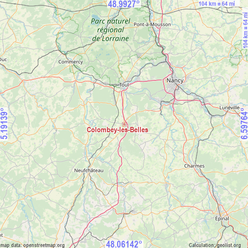
Colombey-les-Belles GPS coordinates[2]
48° 31' 45.12" North, 5° 53' 40.236" East
| Map corner | latitude | longitude |
|---|---|---|
| Upper-left | 48.9927°, | 5.19139° |
| Center: | 48.5292°, | 5.89451° |
| Lower-right: | 48.06142°, | 6.59764° |
| Map W x H: | 103.5×103.5 km | = 64.3×64.3mi |
| max Lat: | 51.07786° ⇑31% North |
| Colombey-les-Belles: | 48.5292° |
| min Lat: | ⇓69% South 41.3874° |
| min Long | Colombey-les-Be | max Long |
| -5.08615° | 5.89451° | 9.52242° |
| W 85.9%⇐ | ⇒14.1% E |
Elevation
Elevation of Colombey-les-Belles is 340 m = 1115 ft, and this is 146.3 m = 480 ft above average elevation for this country.
| Max E: |
2333 m = 7654 ft | 15.6% |
| Colombey-les-Belles | 340 m 1115 ft | |
| Avg. | 193.7 m = 635 ft | |
Min E: |
-1 m = -3 ft | 84.4% |
See also: France elevation on elevation.city.
Geographical zone
Colombey-les-Belles is located in North temperate zone (between Tropic of Cancer and the Arctic Circle). Distance of this North polar circle is 2005.2 km =1246 mi to North.| Distance of | km | miles | from Colombey-les-Belles |
|---|---|---|---|
| North Pole | 4611.1 | 2865.2 | to North |
| Arctic Circle | 2005.2 | 1246 | to North |
| Tropic Cancer | 2790 | 1733.6 | to South |
| Equator | 5395.9 | 3352.9 | to South |


Nearby cities:
15 places around Colombey-les-Belles: (largest is in red/bold)
• Allamps
6.6 km =4.1 mi,  287°
287°
• Bicqueley
10.9 km =6.8 mi,  6°
6°
• Blénod-lès-Toul
8.8 km =5.5 mi,  331°
331°
• Chaudeney-sur-Moselle
13.8 km =8.6 mi,  3°
3°
• Domgermain
13.5 km =8.4 mi,  339°
339°
• Dommartin-lès-Toul
15.6 km =9.7 mi, 4°
• Favières
8.4 km =5.2 mi,  148°
148°
• Maizières
13.5 km =8.4 mi,  63°
63°
• Pierre-la-Treiche
13 km =8.1 mi, 12°
• Sexey-aux-Forges
15.3 km =9.5 mi,  47°
47°
• Thuilley-aux-Groseilles
7.6 km =4.7 mi, 48°
• Vannes-le-Châtel
8.4 km =5.2 mi,  283°
283°
• Viterne
11.9 km =7.4 mi, 56°
• Vézelise
15 km =9.3 mi,  108°
108°
• Xeuilley
15.6 km =9.7 mi,  74°
74°
Sources, notices
• [Note1] Compared only with cities in France existing in our database
• [Src1] Map data: © OpenStreetMap contributors (CC-BY-SA)
• [Src2] Other city data from geonames.org with taken over terms of usage.
• [Src3] Geographical zone / Annual Mean Temperature by Robert A. Rohde @ Wikipedia
