Birlenbach geodata
Birlenbach (Grand Est) is a populated place; located in France in Europe/Paris (GMT+2) time zone. With population of 976 people, there are 9012 cities with bigger population in this country. Compared to other cities in France, 79.2% of cities are located further ↓South; 99.3% of cities are located further ←West and 61.6% of cities have lower elevation than Birlenbach. Note1
Administrative division(s):
- Level 1: Grand Est
- Level 2: Bas-Rhin
- Level 3: Arrondissement de Haguenau-Wissembourg
- Level 4: Drachenbronn-Birlenbach


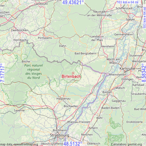
Birlenbach GPS coordinates[2]
48° 58' 36.624" North, 7° 52' 49.044" East
| Map corner | latitude | longitude |
|---|---|---|
| Upper-left | 49.43621°, | 7.17717° |
| Center: | 48.97684°, | 7.88029° |
| Lower-right: | 48.5132°, | 8.58342° |
| Map W x H: | 102.6×102.6 km | = 63.8×63.8mi |
| max Lat: | 51.07786° ⇑20.8% North |
| Birlenbach: | 48.97684° |
| min Lat: | ⇓79.2% South 41.3874° |
| min Long | Birlenbach | max Long |
| -5.08615° | 7.88029° | 9.52242° |
| W 99.3%⇐ | ⇒0.7% E |
Elevation
Elevation of Birlenbach is 178 m = 584 ft, and this is 15.7 m = 52 ft below average elevation for this country.
| Max E: |
2333 m = 7654 ft | 38.4% |
| Avg. | 193.7 m = 635 ft | |
| Birlenbach | 178 m = 584 ft | |
Min E: |
-1 m = -3 ft | 61.6% |
See also: France elevation on elevation.city.
Geographical zone
Birlenbach is located in North temperate zone (between Tropic of Cancer and the Arctic Circle). Distance of this North polar circle is 1955.5 km =1215.1 mi to North.| Distance of | km | miles | from Birlenbach |
|---|---|---|---|
| North Pole | 4561.3 | 2834.3 | to North |
| Arctic Circle | 1955.5 | 1215.1 | to North |
| Tropic Cancer | 2839.8 | 1764.6 | to South |
| Equator | 5445.7 | 3383.8 | to South |


Nearby cities:
15 places around Birlenbach: (largest is in red/bold)
• Betschdorf
8.9 km =5.5 mi,  169°
169°
• Climbach
5.1 km =3.2 mi,  334°
334°
• Gunstett
11 km =6.8 mi,  230°
230°
• Gœrsdorf
8.8 km =5.5 mi,  250°
250°
• Kutzenhausen
5.2 km =3.2 mi,  201°
201°
• Lampertsloch
5.2 km =3.2 mi, 245°
• Langensoultzbach
10.7 km =6.6 mi,  264°
264°
• Lembach
7.2 km =4.5 mi,  294°
294°
• Lobsann
3 km =1.9 mi,  239°
239°
• Merkwiller-Pechelbronn
5.8 km =3.6 mi,  220°
220°
• Preuschdorf
6.8 km =4.2 mi, 238°
• Soultz-sous-Forêts
4.4 km =2.7 mi,  179°
179°
• Surbourg
7.8 km =4.8 mi, 198°
• Wissembourg
8.2 km =5.1 mi,  35°
35°
• Woerth
10.9 km =6.8 mi, 247°
Sources, notices
• [Note1] Compared only with cities in France existing in our database
• [Src1] Map data: © OpenStreetMap contributors (CC-BY-SA)
• [Src2] Other city data from geonames.org with taken over terms of usage.
• [Src3] Geographical zone / Annual Mean Temperature by Robert A. Rohde @ Wikipedia
