Soultz-sous-Forêts geodata
Soultz-sous-Forêts (Grand Est) is a populated place; located in France in Europe/Paris (GMT+2) time zone. With population of 2,662 people, there are 3667 cities with bigger population in this country. Compared to other cities in France, 78.3% of cities are located further ↓South; 99.4% of cities are located further ←West and 55% of cities have lower elevation than Soultz-sous-Forêts. Note1
Administrative division(s):
- Level 1: Grand Est
- Level 2: Bas-Rhin
- Level 3: Arrondissement de Haguenau-Wissembourg
- Level 4: Soultz-sous-Forêts


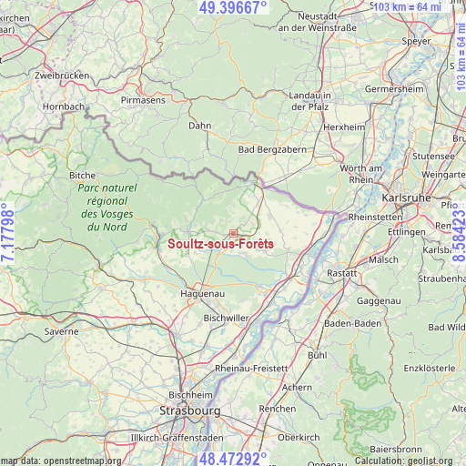
Soultz-sous-Forêts GPS coordinates[2]
48° 56' 12.948" North, 7° 52' 51.96" East
| Map corner | latitude | longitude |
|---|---|---|
| Upper-left | 49.39667°, | 7.17798° |
| Center: | 48.93693°, | 7.8811° |
| Lower-right: | 48.47292°, | 8.58423° |
| Map W x H: | 102.7×102.7 km | = 63.8×63.8mi |
| max Lat: | 51.07786° ⇑21.7% North |
| Soultz-sous-Forêts: | 48.93693° |
| min Lat: | ⇓78.3% South 41.3874° |
| min Long | Soultz-sous-For | max Long |
| -5.08615° | 7.8811° | 9.52242° |
| W 99.4%⇐ | ⇒0.59999999999999% E |
Elevation
Elevation of Soultz-sous-Forêts is 150 m = 492 ft, and this is 43.7 m = 143 ft below average elevation for this country.
| Max E: |
2333 m = 7654 ft | 45% |
| Avg. | 193.7 m = 635 ft | |
| Soultz-sous-Forêts | 150 m = 492 ft | |
Min E: |
-1 m = -3 ft | 55% |
See also: France elevation on elevation.city.
Geographical zone
Soultz-sous-Forêts is located in North temperate zone (between Tropic of Cancer and the Arctic Circle). Distance of this North polar circle is 1959.9 km =1217.8 mi to North.| Distance of | km | miles | from Soultz-sous-Forêts |
|---|---|---|---|
| North Pole | 4565.8 | 2837.1 | to North |
| Arctic Circle | 1959.9 | 1217.8 | to North |
| Tropic Cancer | 2835.4 | 1761.8 | to South |
| Equator | 5441.3 | 3381.1 | to South |


Nearby cities:
15 places around Soultz-sous-Forêts: (largest is in red/bold)
• Betschdorf
4.6 km =2.9 mi,  160°
160°
• Birlenbach
4.4 km =2.7 mi,  359°
359°
• Climbach
9.3 km =5.8 mi,  346°
346°
• Durrenbach
9.4 km =5.8 mi,  241°
241°
• Gunstett
9 km =5.6 mi,  253°
253°
• Gœrsdorf
8.5 km =5.3 mi,  279°
279°
• Hatten
8.2 km =5.1 mi,  118°
118°
• Kutzenhausen
2 km =1.2 mi,  258°
258°
• Lampertsloch
5.3 km =3.3 mi,  295°
295°
• Lembach
10 km =6.2 mi,  318°
318°
• Lobsann
3.9 km =2.4 mi, 318°
• Merkwiller-Pechelbronn
3.8 km =2.4 mi,  271°
271°
• Preuschdorf
5.9 km =3.7 mi, 278°
• Surbourg
3.9 km =2.4 mi,  219°
219°
• Walbourg
8.8 km =5.5 mi,  230°
230°
Sources, notices
• [Note1] Compared only with cities in France existing in our database
• [Src1] Map data: © OpenStreetMap contributors (CC-BY-SA)
• [Src2] Other city data from geonames.org with taken over terms of usage.
• [Src3] Geographical zone / Annual Mean Temperature by Robert A. Rohde @ Wikipedia
