Bengy-sur-Craon geodata
Bengy-sur-Craon (Centre) is a populated place; located in France in Europe/Paris (GMT+2) time zone. With population of 674 people, there are 12156 cities with bigger population in this country. Compared to other cities in France, 55.3% of cities are located further ↑North; 54.2% of cities are located further ←West and 63.8% of cities have lower elevation than Bengy-sur-Craon. Note1
Administrative division(s):
- Level 1: Centre
- Level 2: Cher
- Level 3: Arrondissement de Bourges
- Level 4: Bengy-sur-Craon


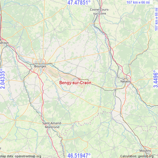
Bengy-sur-Craon GPS coordinates[2]
47° 0' 4.104" North, 2° 44' 47.328" East
| Map corner | latitude | longitude |
|---|---|---|
| Upper-left | 47.47851°, | 2.04335° |
| Center: | 47.00114°, | 2.74648° |
| Lower-right: | 46.51947°, | 3.4496° |
| Map W x H: | 106.6×106.6 km | = 66.2×66.2mi |
| max Lat: | 51.07786° ⇑55.3% North |
| Bengy-sur-Craon: | 47.00114° |
| min Lat: | ⇓44.7% South 41.3874° |
| min Long | Bengy-sur-Craon | max Long |
| -5.08615° | 2.74648° | 9.52242° |
| W 54.2%⇐ | ⇒45.8% E |
Elevation
Elevation of Bengy-sur-Craon is 188 m = 617 ft, and this is 5.7 m = 19 ft below average elevation for this country.
| Max E: |
2333 m = 7654 ft | 36.2% |
| Avg. | 193.7 m = 635 ft | |
| Bengy-sur-Craon | 188 m = 617 ft | |
Min E: |
-1 m = -3 ft | 63.8% |
See also: France elevation on elevation.city.
Geographical zone
Bengy-sur-Craon is located in North temperate zone (between Tropic of Cancer and the Arctic Circle). Distance of this North polar circle is 2175.1 km =1351.5 mi to North.| Distance of | km | miles | from Bengy-sur-Craon |
|---|---|---|---|
| North Pole | 4781 | 2970.8 | to North |
| Arctic Circle | 2175.1 | 1351.5 | to North |
| Tropic Cancer | 2620.1 | 1628.1 | to South |
| Equator | 5226 | 3247.3 | to South |


Nearby cities:
15 places around Bengy-sur-Craon: (largest is in red/bold)
• Avord
8 km =5 mi,  298°
298°
• Baugy
9.1 km =5.7 mi,  351°
351°
• Blet
11.9 km =7.4 mi,  185°
185°
• Brécy
16.7 km =10.4 mi,  324°
324°
• Dun-sur-Auron
18.4 km =11.4 mi,  225°
225°
• Farges-en-Septaine
10.9 km =6.8 mi, 317°
• Jouet-sur-l'Aubois
18.9 km =11.7 mi,  74°
74°
• Jussy-le-Chaudrier
20 km =12.4 mi,  45°
45°
• Nérondes
5.5 km =3.4 mi,  94°
94°
• Ourouer-les-Bourdelins
10.8 km =6.7 mi,  150°
150°
• Saint-Just
18.1 km =11.2 mi,  267°
267°
• Sainte-Solange
21.1 km =13.1 mi, 315°
• Savigny-en-Septaine
14.9 km =9.3 mi,  288°
288°
• Soye-en-Septaine
19.8 km =12.3 mi,  278°
278°
• Torteron
16.8 km =10.4 mi,  81°
81°
Sources, notices
• [Note1] Compared only with cities in France existing in our database
• [Src1] Map data: © OpenStreetMap contributors (CC-BY-SA)
• [Src2] Other city data from geonames.org with taken over terms of usage.
• [Src3] Geographical zone / Annual Mean Temperature by Robert A. Rohde @ Wikipedia
