Beaucouzé geodata
Beaucouzé (Pays de la Loire) is a populated place; located in France in Europe/Paris (GMT+2) time zone. With population of 4,534 people, there are 2177 cities with bigger population in this country. Compared to other cities in France, 50.8% of cities are located further ↓South; 84.8% of cities are located further →East and 79.8% of cities have higher elevation than Beaucouzé. Note1
Administrative division(s):
- Level 1: Pays de la Loire
- Level 2: Département de Maine-et-Loire
- Level 3: Angers
- Level 4: Beaucouzé


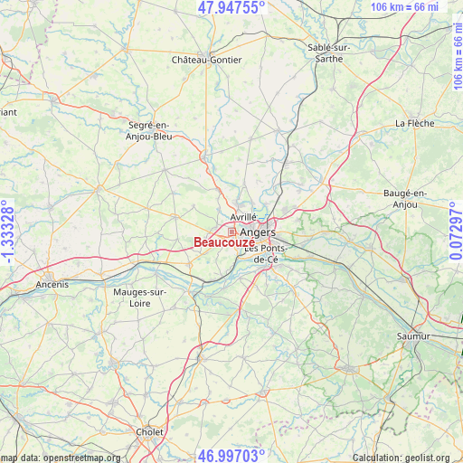
Beaucouzé GPS coordinates[2]
47° 28' 27.984" North, 0° 37' 48.576" West
| Map corner | latitude | longitude |
|---|---|---|
| Upper-left | 47.94755°, | -1.33328° |
| Center: | 47.47444°, | -0.63016° |
| Lower-right: | 46.99703°, | 0.07297° |
| Map W x H: | 105.7×105.7 km | = 65.7×65.7mi |
| max Lat: | 51.07786° ⇑49.2% North |
| Beaucouzé: | 47.47444° |
| min Lat: | ⇓50.8% South 41.3874° |
| min Long | Beaucouzé | max Long |
| -5.08615° | -0.63016° | 9.52242° |
| W 15.2%⇐ | ⇒84.8% E |
Elevation
Elevation of Beaucouzé is 55 m = 180 ft, and this is 138.7 m = 455 ft below average elevation for this country.
| Max E: |
2333 m = 7654 ft | 79.8% |
| Avg. | 193.7 m = 635 ft | |
| Beaucouzé | 55 m = 180 ft | |
Min E: |
-1 m = -3 ft | 20.2% |
See also: France elevation on elevation.city.
Geographical zone
Beaucouzé is located in North temperate zone (between Tropic of Cancer and the Arctic Circle). Distance of this North polar circle is 2122.5 km =1318.9 mi to North.| Distance of | km | miles | from Beaucouzé |
|---|---|---|---|
| North Pole | 4728.4 | 2938.1 | to North |
| Arctic Circle | 2122.5 | 1318.9 | to North |
| Tropic Cancer | 2672.7 | 1660.7 | to South |
| Equator | 5278.7 | 3280 | to South |


Nearby cities:
15 places around Beaucouzé: (largest is in red/bold)
• Angers
6.2 km =3.9 mi,  90°
90°
• Avrillé
4.5 km =2.8 mi,  51°
51°
• Bouchemaine
6 km =3.7 mi,  164°
164°
• Cantenay-Épinard
8.2 km =5.1 mi,  34°
34°
• La Meignanne
5.5 km =3.4 mi,  328°
328°
• La Membrolle-sur-Longuenée
10 km =6.2 mi,  341°
341°
• Le Plessis-Macé
8.3 km =5.2 mi, 336°
• Les Ponts-de-Cé
9.8 km =6.1 mi,  125°
125°
• Mûrs-Erigné
10.2 km =6.3 mi,  143°
143°
• Saint-Lambert-la-Potherie
3.7 km =2.3 mi,  284°
284°
• Saint-Léger-des-Bois
6.1 km =3.8 mi,  257°
257°
• Saint-Martin-du-Fouilloux
7.1 km =4.4 mi,  230°
230°
• Sainte-Gemmes-sur-Loire
8 km =5 mi, 136°
• Savennières
10.4 km =6.5 mi,  191°
191°
• Écouflant
9.9 km =6.2 mi, 50°
Sources, notices
• [Note1] Compared only with cities in France existing in our database
• [Src1] Map data: © OpenStreetMap contributors (CC-BY-SA)
• [Src2] Other city data from geonames.org with taken over terms of usage.
• [Src3] Geographical zone / Annual Mean Temperature by Robert A. Rohde @ Wikipedia
