Beaucourt geodata
Beaucourt (Bourgogne-Franche-Comté) is a populated place; located in France in Europe/Paris (GMT+2) time zone. With population of 5,565 people, there are 1781 cities with bigger population in this country. Compared to other cities in France, 51% of cities are located further ↓South; 94.4% of cities are located further ←West and 91.2% of cities have lower elevation than Beaucourt. Note1
Administrative division(s):
- Level 1: Bourgogne-Franche-Comté
- Level 2: Territoire de Belfort
- Level 3: Arrondissement de Belfort
- Level 4: Beaucourt


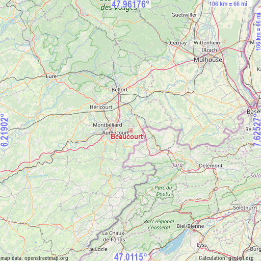
Beaucourt GPS coordinates[2]
47° 29' 19.608" North, 6° 55' 19.704" East
| Map corner | latitude | longitude |
|---|---|---|
| Upper-left | 47.96176°, | 6.21902° |
| Center: | 47.48878°, | 6.92214° |
| Lower-right: | 47.0115°, | 7.62527° |
| Map W x H: | 105.7×105.7 km | = 65.7×65.7mi |
| max Lat: | 51.07786° ⇑49% North |
| Beaucourt: | 47.48878° |
| min Lat: | ⇓51% South 41.3874° |
| min Long | Beaucourt | max Long |
| -5.08615° | 6.92214° | 9.52242° |
| W 94.4%⇐ | ⇒5.6% E |
Elevation
Elevation of Beaucourt is 454 m = 1490 ft, and this is 260.3 m = 854 ft above average elevation for this country.
| Max E: |
2333 m = 7654 ft | 8.8% |
| Beaucourt | 454 m 1490 ft | |
| Avg. | 193.7 m = 635 ft | |
Min E: |
-1 m = -3 ft | 91.2% |
See also: France elevation on elevation.city.
Geographical zone
Beaucourt is located in North temperate zone (between Tropic of Cancer and the Arctic Circle). Distance of this North polar circle is 2120.9 km =1317.9 mi to North.| Distance of | km | miles | from Beaucourt |
|---|---|---|---|
| North Pole | 4726.8 | 2937.1 | to North |
| Arctic Circle | 2120.9 | 1317.9 | to North |
| Tropic Cancer | 2674.3 | 1661.7 | to South |
| Equator | 5280.3 | 3281 | to South |


Nearby cities:
15 places around Beaucourt: (largest is in red/bold)
• Abbévillers
6.3 km =3.9 mi,  183°
183°
• Allenjoie
5.5 km =3.4 mi,  340°
340°
• Audincourt
5.2 km =3.2 mi,  263°
263°
• Badevel
1.8 km =1.1 mi,  52°
52°
• Dampierre-les-Bois
2.1 km =1.3 mi, 340°
• Dasle
2.2 km =1.4 mi,  238°
238°
• Delle
6.2 km =3.9 mi,  69°
69°
• Fesches-le-Châtel
4.1 km =2.5 mi, 342°
• Hérimoncourt
5.9 km =3.7 mi,  210°
210°
• Morvillars
6.7 km =4.2 mi,  7°
7°
• Méziré
5 km =3.1 mi,  358°
358°
• Seloncourt
6 km =3.7 mi, 237°
• Taillecourt
5.1 km =3.2 mi,  277°
277°
• Vandoncourt
2.8 km =1.7 mi, 212°
• Étupes
4.3 km =2.7 mi,  295°
295°
Sources, notices
• [Note1] Compared only with cities in France existing in our database
• [Src1] Map data: © OpenStreetMap contributors (CC-BY-SA)
• [Src2] Other city data from geonames.org with taken over terms of usage.
• [Src3] Geographical zone / Annual Mean Temperature by Robert A. Rohde @ Wikipedia
