Fesches-le-Châtel geodata
Fesches-le-Châtel (Bourgogne-Franche-Comté) is a populated place; located in France in Europe/Paris (GMT+2) time zone. With population of 2,245 people, there are 4286 cities with bigger population in this country. Compared to other cities in France, 51.6% of cities are located further ↓South; 94.3% of cities are located further ←West and 83.5% of cities have lower elevation than Fesches-le-Châtel. Note1
Administrative division(s):
- Level 1: Bourgogne-Franche-Comté
- Level 2: Doubs
- Level 3: Arrondissement de Montbéliard
- Level 4: Fesches-le-Châtel


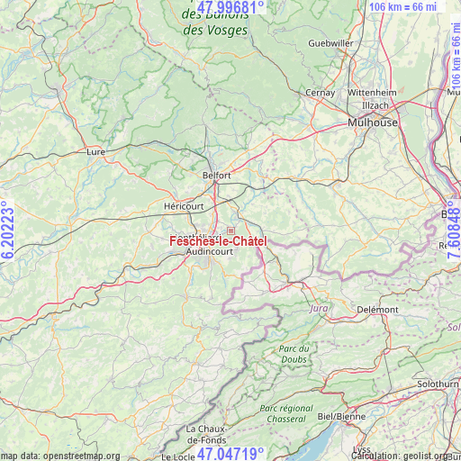
Fesches-le-Châtel GPS coordinates[2]
47° 31' 26.94" North, 6° 54' 19.26" East
| Map corner | latitude | longitude |
|---|---|---|
| Upper-left | 47.99681°, | 6.20223° |
| Center: | 47.52415°, | 6.90535° |
| Lower-right: | 47.04719°, | 7.60848° |
| Map W x H: | 105.6×105.6 km | = 65.6×65.6mi |
| max Lat: | 51.07786° ⇑48.4% North |
| Fesches-le-Châtel: | 47.52415° |
| min Lat: | ⇓51.6% South 41.3874° |
| min Long | Fesches-le-Châ | max Long |
| -5.08615° | 6.90535° | 9.52242° |
| W 94.3%⇐ | ⇒5.7% E |
Elevation
Elevation of Fesches-le-Châtel is 328 m = 1076 ft, and this is 134.3 m = 441 ft above average elevation for this country.
| Max E: |
2333 m = 7654 ft | 16.5% |
| Fesches-le-Châtel | 328 m 1076 ft | |
| Avg. | 193.7 m = 635 ft | |
Min E: |
-1 m = -3 ft | 83.5% |
See also: France elevation on elevation.city.
Geographical zone
Fesches-le-Châtel is located in North temperate zone (between Tropic of Cancer and the Arctic Circle). Distance of this North polar circle is 2117 km =1315.4 mi to North.| Distance of | km | miles | from Fesches-le-Châtel |
|---|---|---|---|
| North Pole | 4722.9 | 2934.7 | to North |
| Arctic Circle | 2117 | 1315.4 | to North |
| Tropic Cancer | 2678.3 | 1664.2 | to South |
| Equator | 5284.2 | 3283.4 | to South |


Nearby cities:
15 places around Fesches-le-Châtel: (largest is in red/bold)
• Allenjoie
1.3 km =0.8 mi,  333°
333°
• Badevel
3.9 km =2.4 mi,  136°
136°
• Beaucourt
4.1 km =2.5 mi,  162°
162°
• Bourogne
4.4 km =2.7 mi,  10°
10°
• Châtenois-les-Forges
5.7 km =3.5 mi,  312°
312°
• Dambenois
3.7 km =2.3 mi, 309°
• Dampierre-les-Bois
2.1 km =1.3 mi, 164°
• Dasle
5.1 km =3.2 mi,  186°
186°
• Grandvillars
5.2 km =3.2 mi,  71°
71°
• Morvillars
3.5 km =2.2 mi,  38°
38°
• Méziré
1.5 km =0.9 mi,  48°
48°
• Nommay
5 km =3.1 mi,  287°
287°
• Taillecourt
5 km =3.1 mi,  229°
229°
• Vieux-Charmont
5.1 km =3.2 mi,  267°
267°
• Étupes
3.3 km =2.1 mi, 231°
Sources, notices
• [Note1] Compared only with cities in France existing in our database
• [Src1] Map data: © OpenStreetMap contributors (CC-BY-SA)
• [Src2] Other city data from geonames.org with taken over terms of usage.
• [Src3] Geographical zone / Annual Mean Temperature by Robert A. Rohde @ Wikipedia
