Allenjoie geodata
Allenjoie (Bourgogne-Franche-Comté) is a populated place; located in France in Europe/Paris (GMT+2) time zone. With population of 649 people, there are 12531 cities with bigger population in this country. Compared to other cities in France, 51.7% of cities are located further ↓South; 94.3% of cities are located further ←West and 83.6% of cities have lower elevation than Allenjoie. Note1
Administrative division(s):
- Level 1: Bourgogne-Franche-Comté
- Level 2: Doubs
- Level 3: Arrondissement de Montbéliard
- Level 4: Allenjoie


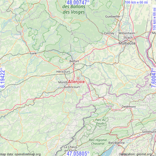
Allenjoie GPS coordinates[2]
47° 32' 5.676" North, 6° 53' 50.46" East
| Map corner | latitude | longitude |
|---|---|---|
| Upper-left | 48.00747°, | 6.19422° |
| Center: | 47.53491°, | 6.89735° |
| Lower-right: | 47.05805°, | 7.60047° |
| Map W x H: | 105.6×105.6 km | = 65.6×65.6mi |
| max Lat: | 51.07786° ⇑48.3% North |
| Allenjoie: | 47.53491° |
| min Lat: | ⇓51.7% South 41.3874° |
| min Long | Allenjoie | max Long |
| -5.08615° | 6.89735° | 9.52242° |
| W 94.3%⇐ | ⇒5.7% E |
Elevation
Elevation of Allenjoie is 330 m = 1083 ft, and this is 136.3 m = 447 ft above average elevation for this country.
| Max E: |
2333 m = 7654 ft | 16.4% |
| Allenjoie | 330 m 1083 ft | |
| Avg. | 193.7 m = 635 ft | |
Min E: |
-1 m = -3 ft | 83.6% |
See also: France elevation on elevation.city.
Geographical zone
Allenjoie is located in North temperate zone (between Tropic of Cancer and the Arctic Circle). Distance of this North polar circle is 2115.8 km =1314.7 mi to North.| Distance of | km | miles | from Allenjoie |
|---|---|---|---|
| North Pole | 4721.7 | 2933.9 | to North |
| Arctic Circle | 2115.8 | 1314.7 | to North |
| Tropic Cancer | 2679.5 | 1665 | to South |
| Equator | 5285.4 | 3284.2 | to South |


Nearby cities:
15 places around Allenjoie: (largest is in red/bold)
• Badevel
5.2 km =3.2 mi,  140°
140°
• Beaucourt
5.5 km =3.4 mi,  160°
160°
• Bourogne
3.4 km =2.1 mi,  24°
24°
• Châtenois-les-Forges
4.5 km =2.8 mi,  305°
305°
• Dambenois
2.5 km =1.6 mi,  297°
297°
• Dampierre-les-Bois
3.4 km =2.1 mi, 159°
• Fesches-le-Châtel
1.3 km =0.8 mi,  153°
153°
• Grand-Charmont
5.4 km =3.4 mi,  260°
260°
• Grandvillars
5.5 km =3.4 mi,  84°
84°
• Morvillars
3.2 km =2 mi,  61°
61°
• Méziré
1.8 km =1.1 mi,  95°
95°
• Nommay
4.2 km =2.6 mi,  274°
274°
• Taillecourt
5.5 km =3.4 mi,  216°
216°
• Vieux-Charmont
4.7 km =2.9 mi,  252°
252°
• Étupes
3.9 km =2.4 mi,  211°
211°
Sources, notices
• [Note1] Compared only with cities in France existing in our database
• [Src1] Map data: © OpenStreetMap contributors (CC-BY-SA)
• [Src2] Other city data from geonames.org with taken over terms of usage.
• [Src3] Geographical zone / Annual Mean Temperature by Robert A. Rohde @ Wikipedia
