Badevel geodata
Badevel (Bourgogne-Franche-Comté) is a populated place; located in France in Europe/Paris (GMT+2) time zone. With population of 759 people, there are 11065 cities with bigger population in this country. Compared to other cities in France, 51.1% of cities are located further ↓South; 94.5% of cities are located further ←West and 85.6% of cities have lower elevation than Badevel. Note1
Administrative division(s):
- Level 1: Bourgogne-Franche-Comté
- Level 2: Doubs
- Level 3: Arrondissement de Montbéliard
- Level 4: Badevel


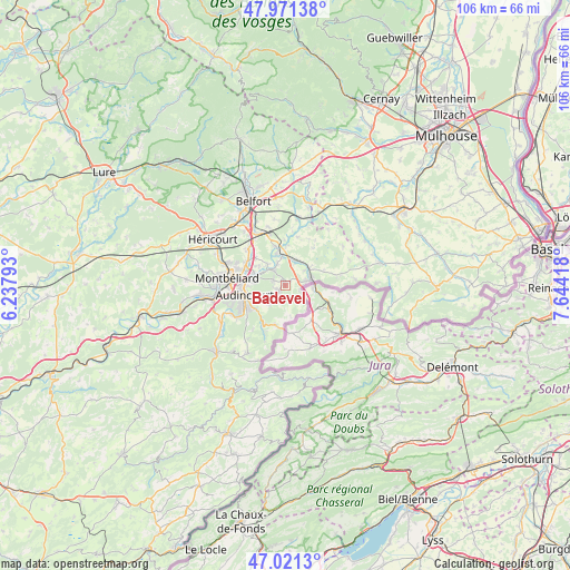
Badevel GPS coordinates[2]
47° 29' 54.564" North, 6° 56' 27.816" East
| Map corner | latitude | longitude |
|---|---|---|
| Upper-left | 47.97138°, | 6.23793° |
| Center: | 47.49849°, | 6.94106° |
| Lower-right: | 47.0213°, | 7.64418° |
| Map W x H: | 105.6×105.6 km | = 65.6×65.6mi |
| max Lat: | 51.07786° ⇑48.9% North |
| Badevel: | 47.49849° |
| min Lat: | ⇓51.1% South 41.3874° |
| min Long | Badevel | max Long |
| -5.08615° | 6.94106° | 9.52242° |
| W 94.5%⇐ | ⇒5.5% E |
Elevation
Elevation of Badevel is 354 m = 1161 ft, and this is 160.3 m = 526 ft above average elevation for this country.
| Max E: |
2333 m = 7654 ft | 14.4% |
| Badevel | 354 m 1161 ft | |
| Avg. | 193.7 m = 635 ft | |
Min E: |
-1 m = -3 ft | 85.6% |
See also: France elevation on elevation.city.
Geographical zone
Badevel is located in North temperate zone (between Tropic of Cancer and the Arctic Circle). Distance of this North polar circle is 2119.8 km =1317.2 mi to North.| Distance of | km | miles | from Badevel |
|---|---|---|---|
| North Pole | 4725.7 | 2936.4 | to North |
| Arctic Circle | 2119.8 | 1317.2 | to North |
| Tropic Cancer | 2675.4 | 1662.4 | to South |
| Equator | 5281.3 | 3281.6 | to South |


Nearby cities:
15 places around Badevel: (largest is in red/bold)
• Allenjoie
5.2 km =3.2 mi,  320°
320°
• Audincourt
6.8 km =4.2 mi,  255°
255°
• Beaucourt
1.8 km =1.1 mi,  232°
232°
• Bourogne
7.4 km =4.6 mi,  345°
345°
• Dampierre-les-Bois
2.3 km =1.4 mi,  292°
292°
• Dasle
4 km =2.5 mi,  235°
235°
• Delle
4.5 km =2.8 mi,  76°
76°
• Fesches-le-Châtel
3.9 km =2.4 mi, 316°
• Grandvillars
5.1 km =3.2 mi,  26°
26°
• Joncherey
5.8 km =3.6 mi,  54°
54°
• Morvillars
5.6 km =3.5 mi, 354°
• Méziré
4.2 km =2.6 mi,  338°
338°
• Taillecourt
6.5 km =4 mi,  266°
266°
• Vandoncourt
4.5 km =2.8 mi,  220°
220°
• Étupes
5.3 km =3.3 mi,  278°
278°
Sources, notices
• [Note1] Compared only with cities in France existing in our database
• [Src1] Map data: © OpenStreetMap contributors (CC-BY-SA)
• [Src2] Other city data from geonames.org with taken over terms of usage.
• [Src3] Geographical zone / Annual Mean Temperature by Robert A. Rohde @ Wikipedia
