Bayenghem-lès-Éperlecques geodata
Bayenghem-lès-Éperlecques (Hauts-de-France) is a populated place; located in France in Europe/Paris (GMT+2) time zone. With population of 901 people, there are 9647 cities with bigger population in this country. Compared to other cities in France, 99.4% of cities are located further ↓South; 55.6% of cities are located further →East and 81.8% of cities have higher elevation than Bayenghem-lès-Éperlecques. Note1
Administrative division(s):
- Level 1: Hauts-de-France
- Level 2: Pas-de-Calais
- Level 3: Arrondissement de Saint-Omer
- Level 4: Bayenghem-lès-Éperlecques
Current local time in Bayenghem-lès-Éperlecques:
10:38 PM, FridayDifference from your time zone: hours


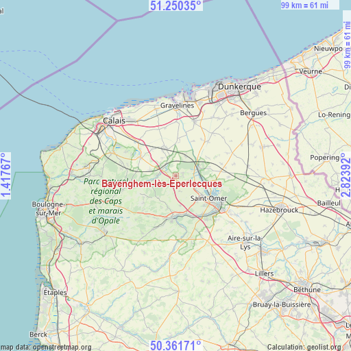
Bayenghem-lès-Éperlecques GPS coordinates[2]
50° 48' 29.304" North, 2° 7' 14.88" East
| Map corner | latitude | longitude |
|---|---|---|
| Upper-left | 51.25035°, | 1.41767° |
| Center: | 50.80814°, | 2.1208° |
| Lower-right: | 50.36171°, | 2.82392° |
| Map W x H: | 98.8×98.8 km | = 61.4×61.4mi |
| max Lat: | 51.07786° ⇑0.6% North |
| Bayenghem-lès-Éperlecques: | 50.80814° |
| min Lat: | ⇓99.4% South 41.3874° |
| min Long | Bayenghem-lès- | max Long |
| -5.08615° | 2.1208° | 9.52242° |
| W 44.4%⇐ | ⇒55.6% E |
Elevation
Elevation of Bayenghem-lès-Éperlecques is 50 m = 164 ft, and this is 143.7 m = 471 ft below average elevation for this country.
| Max E: |
2333 m = 7654 ft | 81.8% |
| Avg. | 193.7 m = 635 ft | |
| Bayenghem-lès-Éperlecques | 50 m = 164 ft | |
Min E: |
-1 m = -3 ft | 18.2% |
See also: France elevation on elevation.city.
Geographical zone
Bayenghem-lès-Éperlecques is located in North temperate zone (between Tropic of Cancer and the Arctic Circle). Distance of this North polar circle is 1751.8 km =1088.5 mi to North.| Distance of | km | miles | from Bayenghem-lès-Éperlecques |
|---|---|---|---|
| North Pole | 4357.7 | 2707.7 | to North |
| Arctic Circle | 1751.8 | 1088.5 | to North |
| Tropic Cancer | 3043.4 | 1891.1 | to South |
| Equator | 5649.3 | 3510.3 | to South |


Nearby cities:
15 places around Bayenghem-lès-Éperlecques: (largest is in red/bold)
• Bonningues-lès-Ardres
7.6 km =4.7 mi,  257°
257°
• Houlle
3.9 km =2.4 mi,  111°
111°
• Mentque-Nortbécourt
3.7 km =2.3 mi,  222°
222°
• Moulle
4.5 km =2.8 mi,  118°
118°
• Nordausques
3 km =1.9 mi,  292°
292°
• Polincove
4.9 km =3 mi,  334°
334°
• Recques-sur-Hem
3.7 km =2.3 mi,  321°
321°
• Ruminghem
6.3 km =3.9 mi,  24°
24°
• Serques
5.9 km =3.7 mi, 106°
• Tilques
6.5 km =4 mi, 121°
• Tournehem-sur-la-Hem
5.1 km =3.2 mi, 259°
• Watten
7.2 km =4.5 mi,  63°
63°
• Zudausques
6.9 km =4.3 mi,  164°
164°
• Zutkerque
6.2 km =3.9 mi, 323°
• Éperlecques
2.2 km =1.4 mi,  97°
97°
Sources, notices
• [Note1] Compared only with cities in France existing in our database
• [Src1] Map data: © OpenStreetMap contributors (CC-BY-SA)
• [Src2] Other city data from geonames.org with taken over terms of usage.
• [Src3] Geographical zone / Annual Mean Temperature by Robert A. Rohde @ Wikipedia
