Banize geodata
Banize (Nouvelle-Aquitaine) is a seat of a fourth-order administrative division; located in France in Europe/Paris (GMT+2) time zone. With population of 164 people, there are 15241 cities with bigger population in this country. Compared to other cities in France, 68.1% of cities are located further ↑North; 56.3% of cities are located further →East and 95.5% of cities have lower elevation than Banize. Note1
Administrative division(s):
- Level 1: Nouvelle-Aquitaine
- Level 2: Creuse
- Level 3: Arrondissement de Guéret
- Level 4: Banize


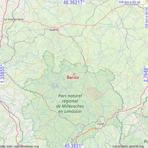
Banize GPS coordinates[2]
45° 52' 29.244" North, 2° 3' 42.048" East
| Map corner | latitude | longitude |
|---|---|---|
| Upper-left | 46.36217°, | 1.35855° |
| Center: | 45.87479°, | 2.06168° |
| Lower-right: | 45.3831°, | 2.7648° |
| Map W x H: | 108.9×108.9 km | = 67.7×67.7mi |
| max Lat: | 51.07786° ⇑68.1% North |
| Banize: | 45.87479° |
| min Lat: | ⇓31.9% South 41.3874° |
| min Long | Banize | max Long |
| -5.08615° | 2.06168° | 9.52242° |
| W 43.7%⇐ | ⇒56.3% E |
Elevation
Elevation of Banize is 611 m = 2005 ft, and this is 417.3 m = 1369 ft above average elevation for this country.
| Max E: |
2333 m = 7654 ft | 4.5% |
| Banize | 611 m 2005 ft | |
| Avg. | 193.7 m = 635 ft | |
Min E: |
-1 m = -3 ft | 95.5% |
See also: France elevation on elevation.city.
Geographical zone
Banize is located in North temperate zone (between Tropic of Cancer and the Arctic Circle). Distance of this North polar circle is 2300.4 km =1429.4 mi to North.| Distance of | km | miles | from Banize |
|---|---|---|---|
| North Pole | 4906.3 | 3048.6 | to North |
| Arctic Circle | 2300.4 | 1429.4 | to North |
| Tropic Cancer | 2494.9 | 1550.3 | to South |
| Equator | 5100.8 | 3169.5 | to South |


Nearby cities:
15 places around Banize: (largest is in red/bold)
• Ahun
23.5 km =14.6 mi,  356°
356°
• Aubusson
12.1 km =7.5 mi,  42°
42°
• Blessac
10.6 km =6.6 mi,  27°
27°
• Bourganeuf
25.2 km =15.7 mi,  290°
290°
• Crocq
23.8 km =14.8 mi,  91°
91°
• Felletin
8.7 km =5.4 mi,  83°
83°
• La Courtine
24.9 km =15.5 mi,  141°
141°
• Lavaveix-les-Mines
22 km =13.7 mi,  5°
5°
• Nedde
24.8 km =15.4 mi,  225°
225°
• Peyrat-le-Château
23.4 km =14.5 mi,  253°
253°
• Peyrelevade
19 km =11.8 mi,  181°
181°
• Royère-de-Vassivière
12.1 km =7.5 mi, 247°
• Saint-Amand
16.4 km =10.2 mi, 43°
• Saint-Médard-la-Rochette
20.6 km =12.8 mi,  19°
19°
• Sornac
25.2 km =15.7 mi,  156°
156°
Sources, notices
• [Note1] Compared only with cities in France existing in our database
• [Src1] Map data: © OpenStreetMap contributors (CC-BY-SA)
• [Src2] Other city data from geonames.org with taken over terms of usage.
• [Src3] Geographical zone / Annual Mean Temperature by Robert A. Rohde @ Wikipedia
