Peyrat-le-Château geodata
Peyrat-le-Château (Nouvelle-Aquitaine) is a populated place; located in France in Europe/Paris (GMT+2) time zone. With population of 1,140 people, there are 7890 cities with bigger population in this country. Compared to other cities in France, 69.1% of cities are located further ↑North; 59.7% of cities are located further →East and 91.2% of cities have lower elevation than Peyrat-le-Château. Note1
Administrative division(s):
- Level 1: Nouvelle-Aquitaine
- Level 2: Haute-Vienne
- Level 3: Arrondissement de Limoges
- Level 4: Peyrat-le-Château


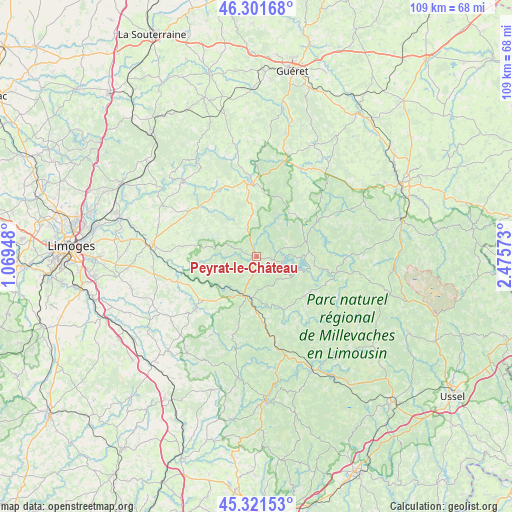
Peyrat-le-Château GPS coordinates[2]
45° 48' 49.536" North, 1° 46' 21.36" East
| Map corner | latitude | longitude |
|---|---|---|
| Upper-left | 46.30168°, | 1.06948° |
| Center: | 45.81376°, | 1.7726° |
| Lower-right: | 45.32153°, | 2.47573° |
| Map W x H: | 109×109 km | = 67.7×67.7mi |
| max Lat: | 51.07786° ⇑69.1% North |
| Peyrat-le-Château: | 45.81376° |
| min Lat: | ⇓30.9% South 41.3874° |
| min Long | Peyrat-le-Chât | max Long |
| -5.08615° | 1.7726° | 9.52242° |
| W 40.3%⇐ | ⇒59.7% E |
Elevation
Elevation of Peyrat-le-Château is 453 m = 1486 ft, and this is 259.3 m = 851 ft above average elevation for this country.
| Max E: |
2333 m = 7654 ft | 8.8% |
| Peyrat-le-Château | 453 m 1486 ft | |
| Avg. | 193.7 m = 635 ft | |
Min E: |
-1 m = -3 ft | 91.2% |
See also: France elevation on elevation.city.
Geographical zone
Peyrat-le-Château is located in North temperate zone (between Tropic of Cancer and the Arctic Circle). Distance of this North polar circle is 2307.2 km =1433.6 mi to North.| Distance of | km | miles | from Peyrat-le-Château |
|---|---|---|---|
| North Pole | 4913 | 3052.8 | to North |
| Arctic Circle | 2307.2 | 1433.6 | to North |
| Tropic Cancer | 2488.1 | 1546 | to South |
| Equator | 5094 | 3165.3 | to South |


Nearby cities:
15 places around Peyrat-le-Château: (largest is in red/bold)
• Banize
23.4 km =14.5 mi,  73°
73°
• Bourganeuf
15.6 km =9.7 mi,  355°
355°
• Bujaleuf
11.3 km =7 mi,  260°
260°
• Champnétery
15.7 km =9.8 mi,  277°
277°
• Châteauneuf-la-Forêt
17.2 km =10.7 mi,  229°
229°
• Eymoutiers
8.7 km =5.4 mi,  195°
195°
• La Geneytouse
23.8 km =14.8 mi, 262°
• Linards
22.5 km =14 mi,  236°
236°
• Nedde
11.4 km =7.1 mi,  156°
156°
• Neuvic-Entier
16.1 km =10 mi, 230°
• Peyrelevade
25 km =15.5 mi,  119°
119°
• Royère-de-Vassivière
11.4 km =7.1 mi,  78°
78°
• Saint-Dizier-Leyrenne
24.5 km =15.2 mi,  348°
348°
• Saint-Léonard-de-Noblat
22 km =13.7 mi, 276°
• Sauviat-sur-Vige
16.4 km =10.2 mi,  308°
308°
Sources, notices
• [Note1] Compared only with cities in France existing in our database
• [Src1] Map data: © OpenStreetMap contributors (CC-BY-SA)
• [Src2] Other city data from geonames.org with taken over terms of usage.
• [Src3] Geographical zone / Annual Mean Temperature by Robert A. Rohde @ Wikipedia
